

gnu
-
Posts
1,146 -
Joined
-
Last visited
Content Type
Profiles
Forums
Events
Posts posted by gnu
-
-
Do you have 11821 Wilcrest? Maybe that wasn't in Houston City Limits in the 70's?
-
Maybe they didn't officially rebrand the old Randall's Super Valu stores until they had to, which would have been 1966.
Along the lines of Randalls #5 and #9 maybe the missing Super Valu locations are in Pasadena (as you suggested).
Wonder where you could find 5 and 9. Old newspaper ad with all locations?
-
So not sure this helps you or if you already have it or not but I looked it up in my city directories for 1966 and 1976.
1976 it lists 4615 Mangum as Randall's with Mgr Randall Onstead.
1966 it is NOT listed as a Randall's but as the Mangum Minimax.
Here is the rest of the information on Randall's from those two years.
1976: Randall's Food Stores (no store numbers listed)
5550 North Frwy (Billy Young, mgr) This is PLAZA MINIMAX in 1966. Structure built 1960 per HCAD.
9448 Long Point (Harold Westbrook, mgr) Nothing at this address in 1966
11621 Katy Frwy (Cletia Rogers, mgr) Nothing here is 1966 either
4615 Mangum (Randall Onstead, mgr) This is MANGUM MINIMAX in 1966. Structure built 1956 per HCAD.
(also had another listing at the same Mangum address as "super market" instead of "food stores" with Joseph R. Alexander as manager)
1966: Randall's Super Markets (Robert Onstead)
No.1: 7528 South Park
No.2: Not listed
No.3: 10810 South Post Oak
No.4: 6019 Bellfort
No.5: 5714 Bissonnet
No.6: Not listed
No.7: Not listed
No.8: 1633 S. Voss
No.9: 6811 Bellfort
The 1966 listings are the Randall's Super Value Markets since the new Randall's Food Market was only founded in July of 1966. According to Robert Onstead's obituary, they sold the original chain in 1962 to Hubbard out of El Paso. They changed the name to Food Mart and then Piggly Wiggly. Interesting that in 1966 it still shows up as Randall's Super Markets.
-
 1
1
-
-
There was a Randall's at 43rd and Mangum. It was in the wedge north of 43rd between Mangum and the RR tracks. The building is still extant and evidently it is now a school called the Mangum Education Center (according to google maps).
The old school Randall's post sign was still in the parking lot in the early 2000s (I have a photo of it somewhere).
https://www.google.com/maps/@29.8337611,-95.4620966,622m/data=!3m1!1e3
-
2
-
-
Also 707 N. Alexander in Baytown. It's currently a General Wok
Meant to provide this list of former Houston-area Taco Bueno locations from the December 1986-87 Greater Houston business pages.
Houston
1460 Blalock
8980 Clearwood
3804 S. Gessner
8767 S. Gessner
19910 Park Row
La Porte
117 SH 146 S.
Pasadena
5425 Red Bluff
302 Southmore
3122 Spencer Hwy
1212 Starkey
-
1
-
-
Anyone know what the Foodarama at 5665 Beechnut was? Seems like it may have been built as a Weingartens but was it ever a Safeway?
My 1966 directory says it was indeed a Weingarten's.
Also, according the directory, It seems that it opened first, while the rest of Maplewood Mall was still under construction.
My 1976 directory shows that it was already a Foodarama by then.
-
3200 block of Parkwood
Yep, you are right. Sorry.
Technically EAST Parkwood ends at the County Line. The addresses change to FM 528 in Harris County.
Opened as a Safeway in 1983, Switch to Apple Tree, Became Kroger in the 90s, and then Kroger moved across to the old Albertsons after they closed.
-
Safeway/apple tree on Bay Area @ Parkwood in friendswood
Arch MemoH, Do you know the exact address where the Safeway in Friendswood was? I looked at the maps and coudn't see the old store and it's design.
My memory may be going but I think you are mistaken. Nothing was even built there until the mid 80's and that was on the north corners.
The south corners weren't developed until the late 90s.
At that corner was/is:
NW - old Kroger, currently Dollar Tree
NE - Randall's, currently Spec's
SE - Albertson's, currently Kroger
SW - nothing, currently Walgreens
The Safeway in Friendswood was on the SW corner of 518 and 2351 (Currently O'Reilly Auto and Ace Hardware)
-
There are two other photos of the mansion in the same collection.
One looks out from the front balcony showing the entrance "circle" and the other is an interior shot.
http://digital.houstonlibrary.org/cdm/ref/collection/images/id/3712
http://digital.houstonlibrary.org/cdm/ref/collection/images/id/3715
I cannot find any real clues other than you can see several other structures nearby.
-
1
-
-
^
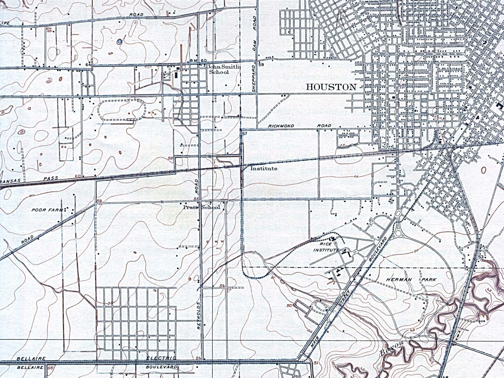
Not to hijack the thread but do you recall what was in the strip center on the SW corner of S. Braeswood and Chimney Rock where there is a small, dumpy HEB now? Must've been a grocery, 5 & 10 or hardware in that space.
My old '66 directory says it was a Rice
-
Cameron Iron Works
-
2
-
-
Maybe someone can answer this. What was the reason to have to change exchange names that have the same first 2 letters? Why did it matter whether it was WAyside or WAlnut? The both represented the same numbers (92). Was it just to standardize the names nationally or something?
-
Okay, I got curious and looked it up in the 1915 city directory in the online digital archives:
http://digital.houstonlibrary.org/cdm/compoundobject/collection/citydir/id/9424/rec/7
Go to page 164.
Here is the citation:
Colonial Amusement Park Co. (Inc)
Edward Paggi (Sarasota, Tex), pres
Wm F Ames, vice pres
Wm Paggi, sec
George J Breinig, treas
e s Fannin 1/2 mi s GH&SA
And just to note, i could not find the listing in the 1917 city directory (already closed?).
So the description seems to put it near Southmore - as Subdude noted.
a half mile s of the railroad, makes it near Calumet and Binz, close to the MFA.
Maybe the parking lot across from St. Pauls was part of it?
topographic maps from 1915 and 1921 show a winding path (driveway?) and two "houses" at the end.
http://www.lib.utexas.edu/maps/topo/texas/txu-pclmaps-topo-tx-bellaire-1915.jpg
http://www.lib.utexas.edu/maps/historical/houston_sw21.jpg
The closest Sanborn maps to 1915 (1925 edition) already show the area platted in the street grid but with only a few houses. The areas north of Calumet have many more houses. However, there doesn't seem to be any obvious remnants of the park left that Sanborn wanted to show. (pg 575)
-
2
-
-
My 1957 phone books lists 5600 Westheimer as Lewis & Coker Store #3
Tanglewood Pharmacy is at 5654 Westheimer
Jack & Jill Liquor at 5614 Westheimer
Looks like the right spot with the curve in the photo.
other Lewis and Coker locations:
1: 1329 Arlington
2: 2266 W. Holcombe
4: 250 W. 19th
5: 5238 Palm Center
-
1900 Old Spanish Trail, now a Kroger, but sure doesn't look like it was built as one. Was that a former Safeway/AppleTree?
Yes
-
I think there are two different locations in the clip. The first one seems more rural.
The later part of the video looks like the 2nd Jeff Davis Hospital on W. Dallas to me. And that road with the center barrier looks like Allen Parkway.
-
I did a little bit of research:
Henry Stude owned the land where Studewood street is today. I don't believe he ever owned the land where Independence Heights is.
I get the impression that Stude's Woods were somewhere (or all) along present-day Studewood south of Sunset Heights.
However, I did run across the fact that the streetcar line (and later bus route #44) that served Independence Heights was called the Studewood.The streetcar turned around at 30th and N.Main. Maybe the residents back then would say they lived at the end of the Studewood line and they eventually just started calling where they were going Studewood. And since there was no real "Stude's Woods" anymore (after the subdivisions filled in)......Just a thought.
Hope this helps.
EDIT: Not sure when Metro (or its forerunner) changed the 44 from Studewood to Acres Homes.
-
1
-
-
my '57 phone book says Weingarten's No. 7 was at 5100 Harrisburg.
I believe this is the same building shown in the photo.
That building is still extant and, if memory serves, it won some kind of preservation award in the last 10 years.
It was an HEB until the new Gulfgate store opened and is currently an Autozone.
Edit: HCAD says 1948...but we know they aren't always right.
-
1
-
-
This is on Texas Ave in the 70s, clearing 19th century buildings for a skyscraper I'm sure someone can figure out from the position from Jones Hall.
almost certainly for texas commerce tower. looks to me like the store fronts face the 800 block of Texas with Pennzoil in the background.
-
^I bow down to your memory/tracking skills...!
Believe me, my memory is VERY selective. Mostly it looks like this:--->

I just saw West Court on the demo list and thought...hmmmm #8...i wonder....and it was.
Anyway, how could you not remember some of those exchanges with Ashikaga back then.
They were pretty interesting to say the least!
-
Sorry to tell you Ashikaga/Chet (if you may be lurking about) but it looks like your childhood home will be gone after the weekend.
It seems like #8 West Court Drive is now deemed a dangerous building by Neighborhood Protection.
Darn it, I really liked that house. Very cute mission/spanish bungalow.
-
As for the laws you are refering to, those were the Gilmer-Aikin laws of 1949.
Did the new funding structure, created in the Gilmer-Aiken laws, result in the districts voluntarily consolidating with neighboring districts in order to increase their funding?
Or was the consolidation specifics mandated by the state - with the state deciding which districts would stay or merge into others etc?
-
It really pays to read other threads on here. I read earlier this evening the one entitled "Map of Houston's Wards" and it have a very interesting and valuable link to the Harris County Archives web page. On there was a map from 1935 detailing the original boundaries of Aldine ISD. The map was pretty hard to read, but if I read it right, this should be a pretty close spproximation of AISD's boundaries when in was created in May 1935. The district is now 111 square miles, but it was only 91 square miles then, before it annexed parts of two neighboring districts.
I agree. Good find by NeneE.
http://www.hctx.net/archives/Img.aspx?Img=4
It sure is hard for me to tell which lines are boundaries on that map!
Anyway, I have a question for you. Do you know what event or legislation happened in 1947 or 1948 that caused LOTS of new school districts in Texas to be created and/or consolidated into new school districts?
[edit: added link to map]
-
It is the "Y building" I think it dates on campus from about 1949.
I never understood it to be an "aiplane" hangar at UH. I imagine it was a surplus WW2 army structure that was repurposed and moved there.
When I was at UH in the early the 90s, it housed a wind tunnel, engineering student organization offices, a machine shop etc.
I believe there are plans to replace it with another building.


Houston In The 1960s
in Historic Houston
Posted
Just guessing but it would seem to me it would have to be Gray or Calhoun (St. Joseph) since it is one way inbound.
This would also work with the billboard and the tall Gulf sign, that would be visible from the Gulf Freeway.
Maybe Gray and La branch? Seems to sorta work from street view.