

NenaE
-
Posts
2,194 -
Joined
-
Last visited
-
Days Won
5
Content Type
Profiles
Forums
Events
Posts posted by NenaE
-
-
The area around Mason Park has some great foliage. When you cross the bayou it doesn't even feel like you're in the loop, let alone Houston.
That area does have some beautiful mature trees, much like the nearby golf course land. It's easily recognized on the area's aerial maps.
-
Good article. Some of the streets sharp angles reflect the layout of very early 1800's railroad tracks, along with La Porte Road. I can remember watching this construction along with the huge 610 bridge across the ship channel. My high school, Milby, sat very near it all. I've never read about the Milby park land and court battle before. Personally, I'm glad the Harrisburg Frwy didn't get built. Houston is chopped up enough by them.
Oh, and I heard the empty lot right across Broadway and Lawndale was supposed to be turned into a park.
-
 1
1
-
-
and HCAD lists - 1904 Yr. Built Date.
Quality - Good.
-
whoa... whose house was this? W. 20th at Ashland. surprised it's sitting in somewhat of a deteriorated state. The porch rail sections are missing. That's a huge property.

-
from Houston-Architectural Guide (1972)
North Central area - nice candid photos included, but frustrating, no locations mentioned.
Does anyone recognize this building? If it sat on Lyons, it's probably gone.
I'm guessing late 1920's, built - time period, Spanish style. It reminds me of a fire station, with that drive-thru feature. As far as I know, most stations sat on corners, and did not have canopies. Maybe early apartments, It's nice, whatever it was.
-
I think the house is still standing, he also had shop across the street that was torn down some years ago.
Michele C...One of these the house?
1. Lillian
2. Leverkuhn x Lillian (corner)
Materene... nice story.
-
When I was a kid of probably about ten or twelve there was a man that lived a block south of Washington Ave on Lillian street at Leverkhun. He was an old timer then and he build stage coaches from the ground up. Mr. Knepples had learned the trade from his father.
Michelle C, Is the house still standing?
-
There was also an East End Carrabba's store - Canal and 74th. I haven't been able to verify through records which bldg. it actually was.
-
I never heard the word superette until I saw this thread; we just called them little grocery stores. Would the old Weingarten's on Richmond at Mandell have been one? Or was it a lbit too big. But there's a surviving old-style smallish grocery store at 7548 Canal, on the East End: Shew's Food Market. They still sell fresh produce and have a meat counter, unlike the used-to-be-grocery-stores-turned-convenience stores that you see around. The very pleasant proprieters appear to be a young man, his middle-aged father, and the elderly grandfather, sometimes all there at once. Once I asked one of them where the Ramen noodles were, and he said, "Take ten steps straight ahead, turn left, and then take 5 more steps. They're on the left, the third shelf from the bottom." And so they were! I asked him how he knew the number of steps, and he said that he had trained himself that way in order to be able to come into the store after hours when he needed to, without turning on the light. He said they'd had the store since about 1957.
Cool story and building.
Here are two more I ran across in the East End recently.
1. Wing-On Foods - Canal x Super St.
2. Sherman x Latham St.
-
1
-
-
I don't remember a Red Lobster down Dyna, mkultra, but I do remember this little diddy that I used to love, called the Moon Palace. How I miss the Palace...
Could Red Lobster have been in the stand alone building next door to Los Cabos/Moon Palace? I've been trying to put my finger on what that game room used to be for quite some time now. It was obviously a restaurant, but what? It's been driving me crazy. Wouldn't that be something if we ended up answering each other's question? The building certainly doesn't look like an old Red Lobster, but I guess it's possible.
oh yeah... Jojo's, was a coffee shop/ restaurant, old style, like Kip's or Denny's... was where you went after partying into the wee hours.
-
1
-
-
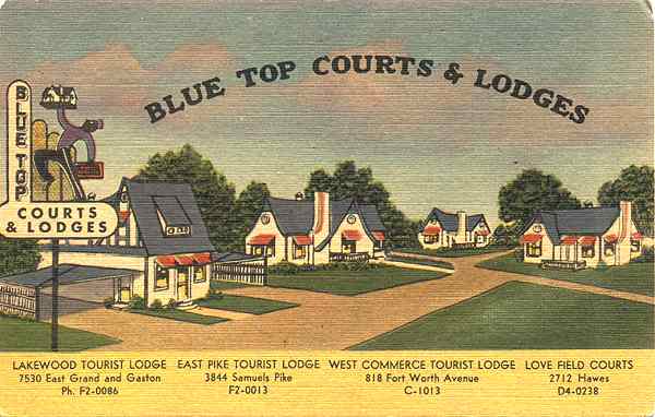
This sign was a cool neon one on Telephone Road, after Winkler. A similar one was at the Courts located on I-45 South (Gulf Frwy) right before Almeda Mall. The later one was a moving sign of some sort. It had a man walking and/ or swinging a suitcase (a vague recollection). Both are now gone.
-
1
-
-
Jack-in-the-Box (now Taqueria) - W. Southmore & Miami (Pasadena)
Whataburger @ 1819 Richey (now Auto Zone) guessing on this one.
Whataburger @ 210 W.Southmore Ave (burned, now Popeyes, new bldg.)
Der Weinerschneitzel @ 901 Southmore Ave. & Witter
Burger Chef @ 2721 Richey (now strip club)
Burger Chef @ 3816 Reveille (burned)
KFC (had bucket sign with Colonel Sanders face on it) @ 7209 S. Loop E. Frwy. (near Gulfgate, Brake Check now)
Taco Bueno - Edgebrook & Clearwood (now First Service -bank?)
Note: these addresses are approximate, from GoogleEarth searches.
-
More from 1976 Houston area - Taco Bell, Wendy's, Dairy Queen, and TGI Fridays (KFC and Burger King are up next but more extensive)
Taco Bell (of the 6 listed, only one still is a Taco Bell)
1803 W 43rd St. (#1010, sold 1996, currently a Prudential Office)
9066 Long Point Rd. (#957, sold 1987, currently Auto Concepts)
5210 Bissonnet St. (#142, sold 1994, currently Roadster Grill)
6523 Westheimer Rd. (#238, demolished? currently strip mall)
330 S 69th St. (#313 - not sure about this one, can't really figure out where this should be unless it's actually Wayside Dr.)
That last Taco Bell sat between S. 69th St. & Wayside Dr. It was in the same space as the Dunkin Donuts. I remember the look of it...original facade, mission style with the bell, like PurpleDevil describes. It had those metal chairs, jutting out from the connected table, like Whataburger.
-
I don't want this to be a Pierce Elevated hijack, and I still stand by the quote in the original paragraph, bolded for emphasis:
What's made the most sense in this discussion is trying to figure out where parkways would still work.
On that related subject, I think given the amount of ROW the light rail took up, Harrisburg Blvd. could've been a viable route for a parkway and could maintain most (if not all) of its businesses. That's what could've been a compromise plan for 225.
Yeah, can't say that I like the look of Harrisburg Blvd. with the light rail, too wide and took out too much. (Can't say that I like it on Main St. either... but that's another topic). So what are your ideas on transporting people via public transportation on a parkway? keep the metro busses, or maybe a throwback trolley system? I'm thinking of the New Orleans garden district one.
-
Not a superette... but it has a launderette attached, like U-totem. I forgot about them. Sunny's had a kid in the logo, I vaguely remember. Guessing 1960's, from the Googie roofline and orange colored sign.
*corner of Baldwin and 301 Tuam.
-
Those neon signs really took on another life at night. Today's signs just aren't the same. The illusion of moving parts was very captivating. I always wondered as a kid, how they did that...for example, the ever popular (red and yellow) arrow, with perfectly timed, consecutive blinking lights, simulating motion.
-
http://www.houstonarchitecture.com/haif/topic/16434-camp-logan-cemetary/?hl=crooms#entry411819
...the link to the old thread. See post #16 for the history of the land, if interested. Similar controversy as Elder St. Lofts. Native American bones? never heard that one before.
I think the sloping terrain posed a problem with that original construction.
Nice interior courtyard design. But I would have incorporated those sloping ledges into some kind of water feature. I believe that spot was originally where water pooled after running down the sloped land, before entering the bayou. Maybe it is intended to be a rainfall runoff spot.
-
Putting the name aside for a second, what about Braeswood / McGregor? Same basic format no?
Those are nice drives. Too bad the bayou view is so unappealing.
-
Ive seen a few new townhomes along rail lines. Thought the same thing.
-
TY... more images taken for my visual notes.
-
Lets not forget the short "Way"...(ex.) S. MacGregor Way.
Another Houston habit is its ending of a street and then continuation of the same name/ street further along the same alignment. Recipe for much confusion before the days of online map searches.
-
... one more thing...
"Although Buffalo Bayou is only 50 miles long, its importance in Texas history cannot be overestimated. It is the only Texas river that flows almost due east; the rest flow predominantly from north to south".
As far back as 1840, the lower part of the bayou was called the "national highway of the republic".
-
3
-
-
Many early neighborhood boulevards were actually designed to be grand, exclusive promenades. No zoning, lapsed restrictions, and rapid city growth have stripped their true identity.
-
1
-
-
The bayou banks we could lose
Once again, a flood-control project threatens Buffalo BayouNice article... see caption and image 9. Yes... more of this.. not concrete. And I like the boulder idea.
Memorial Park was designed as a natural "forest playground", to be guarded from human encroachment.
This is why park change is slow. The idea was engrained long ago, to resist civilizing it like Hermann Park. source: Memorial Park - S.Emmott. (p.27) There have been numerous proposals to alter the park. It was even considered as a possible site for the Astrodome.
I was horrified to see the loss of some of the tallest, possibly oldest trees in the park after the latest hurricanes ripped through Houston. No doubt, the drought furthered the loss. But hopefully new ones have been planted. This city needs more green landscape, not less. The migratory path is a special part of Houston's identity. Abundant wildlife, especially birds are noted in many early visitor's diaries... why, then, do we pose to alter and threaten this huge wildlife attraction?
And, I thought we had recognized that the straightening and hard containment of the bayous and resulting escalation of water downstream was not the answer. Surely, there is a better solution to the erosion issue.
Oh... and yeah, those police horses. pens and stables had been there for quite a while. I always thought they were in a strange location, so close to the freeway. Well, they weren't, originally. The 610 behemoth cut through the wooded area. There was also a horse (exercise?) track south of the stables (GoogleEarth).


Terminating the La Porte Freeway
in Traffic and Transportation
Posted
I like that old Harrisburg has always been ignored, left alone in it's sleepy, suspended state. As a self-professed historian, can't say I'm thrilled about the attention. I'm sure the freeway interchanges need improvement for flow, though. Milby High School has been torn apart this week, to be revitalized. The plans include keeping the original 1920's main bldg. with facade. Also, I heard that the nice 60's designed bank at Lawndale/ Broadway was bulldozed. What a loss. it was beautiful.