

NenaE
-
Posts
2,194 -
Joined
-
Last visited
-
Days Won
5
Content Type
Profiles
Forums
Events
Posts posted by NenaE
-
-
Wow, what a loaded paragraph. Mongrels, hmmm...Makes me think of gypsies. Well, it's a little too late now. It's a smorgasbord out there.
Just to clarify - I was speaking of the zoning...per my quote below.
-
So much is being razed. The developers probably don't want to bother with what they may perceive as just a hinderance (salvage). On a somewhat positive note, I've seen many small homes on blocks near downtown packed up, ready to move, not dozed. One paper I ran across had the addresses of previous slave's homes, along with stories of their lives. I looked up the two Houston ladies homes, both were gone, empty lots. That's sad.
I'm taking photos of as many as possible. The neighborhoods are changing, fast. I'd be ok with it, if they would keep some historic structures, to save the identities of the neighborhoods. Maybe the little corner store. I just don't see it happening. I do see a lot of churches. So many generic town homes are replacing full streets of homes. I'm afraid everything is gonna look the same. It's boring, no matter what name they conjure up. I often wonder...What would Peter Papademetriou and Stephen Fox say?
-
Wow, what a loaded paragraph. Mongrels, hmmm...Makes me think of gypsies. Well, it's a little too late now. It's a smorgasbord out there.
-
It's not. We are talking about 3 McEvoy locations, two business and 1 residence. The thumbnail is one business location.
Here's a HC Block Book map, with the estates you mention, H-Town Man. I was just reading about it, recently. It's also been discussed on HAIF, before. Can't find the link. It was very close to the McGowen house, pictured in Post #1.

-
Yeah, thats the one...RiversideT. and I agree. It has sat vacant for quite a while. Nice to know it's still there. Hope it gets some love. We have an old thread here, on HAIF, that talks about it. Yeah, ArchFan, I agree, salvage or re-use what you can, if it's being wrecked. Unfortunately, the freeways chop up original neighborhood plans, leaving a mangled version. Those houses on the outskirts of the neighborhoods are especially vulnerable. It's a shame. I'm guessing they are hoping to sell the land for future high rise development.
-
But the photo shows a dirt road, shade trees, and grass. No way that's Milam and Franklin. Google Earth has a 1944 aerial and it's packed around there, as I'm sure it would have been going back to the 19th century.
I think that's the house on McGowan's location, not one of the two businesses RiversideT also mentions. One business address was close to Buffalo Bayou, downtown.
...unless Im missing something, here.
-
Any news about the stucco, French-styled one that looked abandoned? it was on the South side, near Hwy 288, one or two streets off the main drive. Had a porte-cochere, drive thru feature, with room on other side. Another style copied in the suburban mcmansion creations.
-
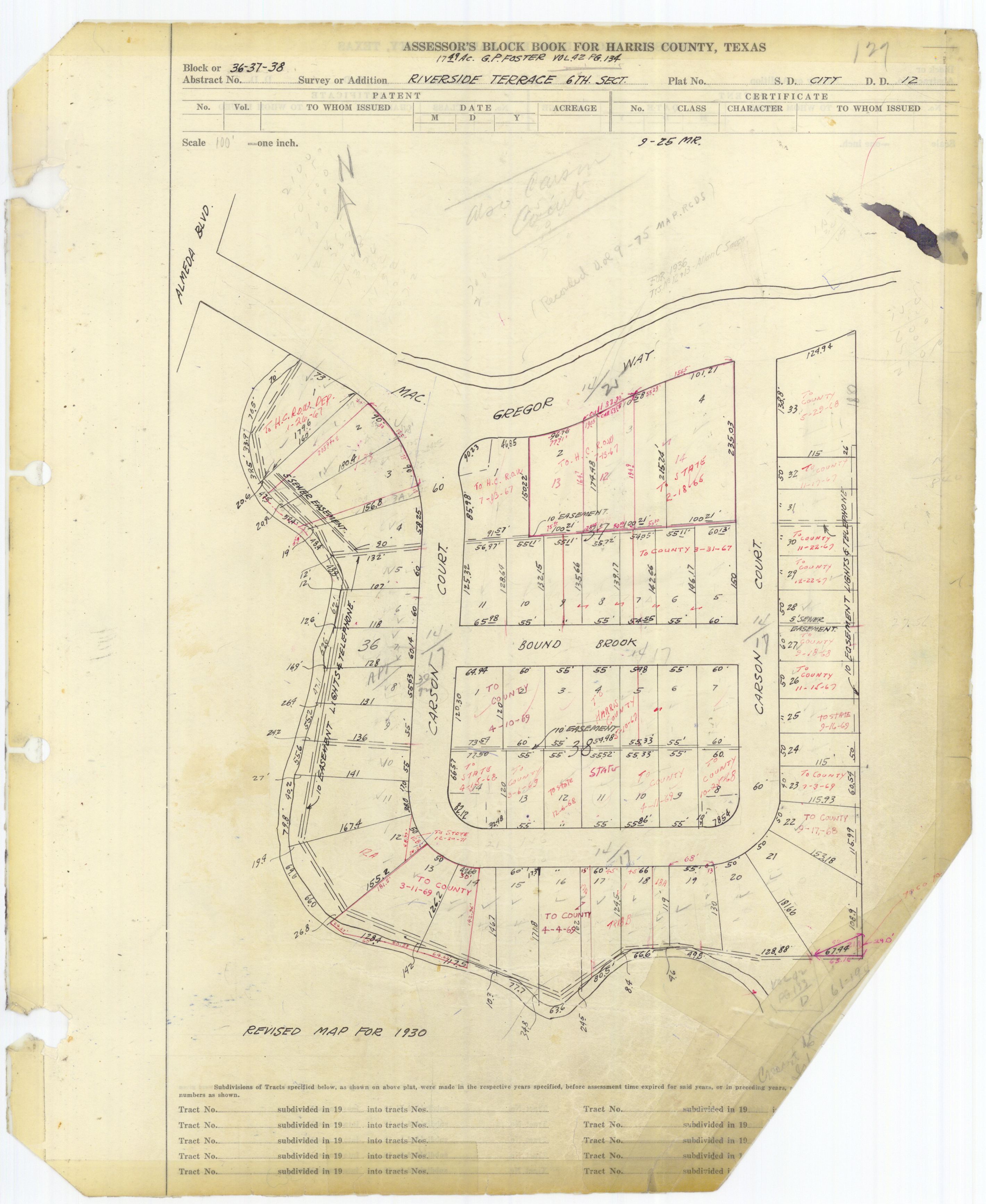
That lot sits under 288 just South of where MacGregor Way comes off of Hermann Deive, East of Almeda. Here's the block book link http://books.tax.hctx.net/v061/AE1997_61-1_0106.jpg. You can see the area on Google Earth rolled back to 1953. It's due East of the Mosaic.
That's interesting. One more mysterious link for the two areas, and people from the Country Club area neighborhoods of Forest Hill & Idylwood. Im talking about the street... N. MacGregor Way.
-
This is the style so many suburban homes copy. Sad story.
-
I may be reaching here but the fact that they lived so close to Forest Park Cemetery leads me to think that he may be right across Lawndale from his home.
I could not find him on Find A Grave but that only means that no one has posted it. I don't have any of the genealogy subscriptions to search those sites but there's a good chance information is available on him.
That would be my first guess. Second would be Evergreen, another old one, down the road.
I drove by the house, to take photos, maybe five years ago. The owner had scaffolding up, was repairing the outside. I'm confident it's in good hands.
Whoa, RiversideT, those interior shots, nice floor.
-
Thank You for sharing your pictures, RiversideT. That is an impressive design. The photos show the detail that went into these huge homes, inside and out. That roofline caught my eye, and the brickwork in the front columns. Do you remember if there were screened sleeping porches, along with the sitting areas, in the bedrooms? They are mentioned in books about old, large Houston houses.
Nice to know the history of the owner, as well. You've done some research.
Looks like the house sat at the corner of McGowen & Helena Streets. The Harris County Block Book maps show that it sat in the Settegast & Upham Addition. I never saw this old home, but my mom stayed in a very old wooden home on McGowen with long columns. It was near the small theater.
The 600 block of Milby falls to the side entrance of the Maxwell House Coffee Plant (previous auto factory).
HCAD lists a "Joseph E. McEvoy" on Peden St., in Rosemont Hts. Extn. Maybe they are related.
-
I visited the old UH football stadium in recent years. It was definitely time for a new one. Great pics, thanks for documenting the progress. Can't wait to attend a game, and see the new structure.
-
I've always hoped that University of Houston or Rice University would eventually acquire the property, through a private donor. Similar to the Med Center's genealogy center/ previous residence. It could be used to house Houston's architectural records, students, and used as a project for historical restoration. It's such a significant structure, a fine example of Joseph Finger's residential work.
Well, at least it's not being bulldozed. Yet.
-
 1
1
-
-
I don't know what to think about this. I thought the owner didn't want to sell the Weingarten house.
-
1
-
-
The old Jack-In-The-Box / Pappas Bar-BQ that sat behind Memorial Hermann-Memorial City Hospital is now gone...soon to be another *$. The green lady is on her way.
-
OK, my childhood memory of a Whataburger with an outdoor, upstairs patio has been confirmed. A "Remember Pasadena" site member has replied that there was one with an upstairs outdoor dining area, located on Richey. That was, until a kid fell off the balcony. Then they got rid of it. My dad never let us go up there. The outdoor chairs were connected to the stainless steel table. They jutted out, each one at an angle. It was a very modern design. Needless to say, I was intrigued by it. There may have been a spiral staircase, as well. Does anyone else remember these?
-
1
-
-
I grew up in SE Houston, Meadowbrook (1945 to 1963) and first number I remember was OLive - 3817. Later a 4 was added after the OL. Friends that lived in the area had MIlby exchange that was later changed to MIssion. Seems like two different numbers were added to MI, but I don't remember the numbers.
In Oak Meadows, in the '60's, ours was MI 3 or 713.
-
The 1947 topography maps show 4 airports South of the crash area. I read somewhere that Ellington used these smaller fields for WWII pilot training, practice (take offs, landings, soft field, touch and go's). I imagine that is why the crash happened so close to residential areas.
--- Skyport (S. of Holmes Rd and Griggs Rd, East of Mykawa)
--- Cunningham Airport (OST at Almeda Rd)
--- S. Main St. Airport (Brays Bayou directly N of)
--- Sam Houston Airport (Largest) near Lotus (town?) N. of Blue Ridge Prison Farm
This info. is on the Park Place and Bellaire maps.
-
...some of these are in SE Houston, some in South Houston/Pasadena, Kemah.
source: Jim Miller, member of "I Grew Up in Pasadena" Facebook page... nice find.
Includes Vicki's Drive In... Winkler at Old Galveston Road, with the martian sign.
-
Hopefully the building you are referencing to will remain standing. It's situated between two renovated properties. Can't hurt it's chances. The Magnolia is a beautiful hotel. I got to stay in it recently. Very tastefully done.
-
1
-
-
The new GoogleEarth street shots are not as sharp as before, don't zoom as well on street view. I would love to see a side-by-side year comparison, like the slide feature in historicaerials. Makes it easy to pinpoint locations of previous structures or bayou changes, etc.
-
Some of the research mentioned the lack of actual legal paperwork, in the form of land deeds, agreements, etc. Some early agreements were verbal, or not well documented due to the acting parties illiteracy. This may explain why some graves could not be located. Nice to hear your stories of the land, Michelle. There are not many of the old homes left. I drove through the area a while ago.
I've not seen any paperwork of graves ever being moved. Makes you wonder.
I've noticed many early Houston cemeteries were located near the bayous. Some graves have been lost to the deterioration of banks, floods. The apartments could actually suffer from unstable foundations, due to the sloping, shoddy design.
-
1
-
-
The earlier flood photo has Henke & Pillot - Largest Grocer's (poss. address - 302 Milam in 1925) and Ship Channel Drug Co. I have viewed some photos of both floods. Second one got the city's attention, in a big way. It prompted Sears to build the S. Main St. store. Thanks for sharing the photos.
-
HPMatt ~ Very interesting information about JP Morgan and Indianola. My grandmother's relatives landed in Indianola, from Germany. She attended Milby HS, knew the Milby daughter.
Welcome to HAIF.
-
1
-


Memories Of Meyerland/Willowbend/Westbury
in Historic Houston
Posted
Informative, JLWM8609. TY. It's always been a favorite neighborhood of mine. Along with Meyerland's architectural gems, I cherish the diversity of Riverside's homes. I love its mix of home styles and the rolling terrain. The smaller ones are just as nice, in my eyes. Talented architects got to see their residential designs built in Riverside, when much of Houston was trying to exclude them. The neighborhood of Riverside Terrace started out as the dream of a Mr. MacGregor, a man of Scottish or Irish ancestry, obviously. His wife carried out his vision, after he died. It's a unique place, among so many cookie cutter neighborhoods. It's a real shame that Hwy. 288 destroyed it's original layout. The racial discrimination is a large aspect of the story, and it needs to be remembered. Yet, I'm happy Riverside Terrace fell and hopefully continues to fall into the hands of people who love, cherish, and protect it's uniqueness, no matter what color of their skin, religious background, or sexual orientation. It's my hope that it keeps it architectural cohesion in an age of such rapid gentrification. It's hard to keep estates (especially large ones) intact when owners pass.
Side note: I read recently that in the early days of the Houston Ward system, the residential ethnic lines were faint, or non-existent.