

citykid09
-
Posts
3,132 -
Joined
-
Last visited
-
Days Won
2
Content Type
Profiles
Forums
Events
Posts posted by citykid09
-
-
That's cool. I just hope that Houston will be able to handle all of the growth without expanding land wise.
-
Bojangles came to Houston back in the 1980's. I recall they had a location that opened across from Olde Oaks on FM 1960. Service was horrible and the food wasn't that much better. Didn't last long.
I've heard good things about Zaxby's though. I think I'll try it this week.
I could have sworn that I posted on here that Bojangles came here around the early part of this decade. Did someone delete it??? I remember they had 2-3 locations, but they closed up pretty quick.
-
I didn't know they entered the Houston area already, can't wait to try it!
Zaxby's
8103 LOUETTA ROAD
SPRING, TX 77379
-
Ahh...Atlanta. What a great city. Lived there for most of the 90's. If you want this to happen to Houston, though, you will need to tear up a lot of our roads and force commuters into narrow corridors with few options for alternate routes. That way development would have to concentrate in response to the hassle of getting around. As long as Houston can spread out in all directions, there isn't a much impetus to concentrate. Unless, of course, gas prices go through the roof again.
It seems to me that concentration is more attractive. Riding down the street and seeing a shopping center would usually not make me want to see the shops within it. But if the area is set up in an urban way where the store are right up to the sidewalk with trees and people walking around, I would want to check that area out. There are thousands of shopping centers in Houston, but how many truly urban areas are there to shop?
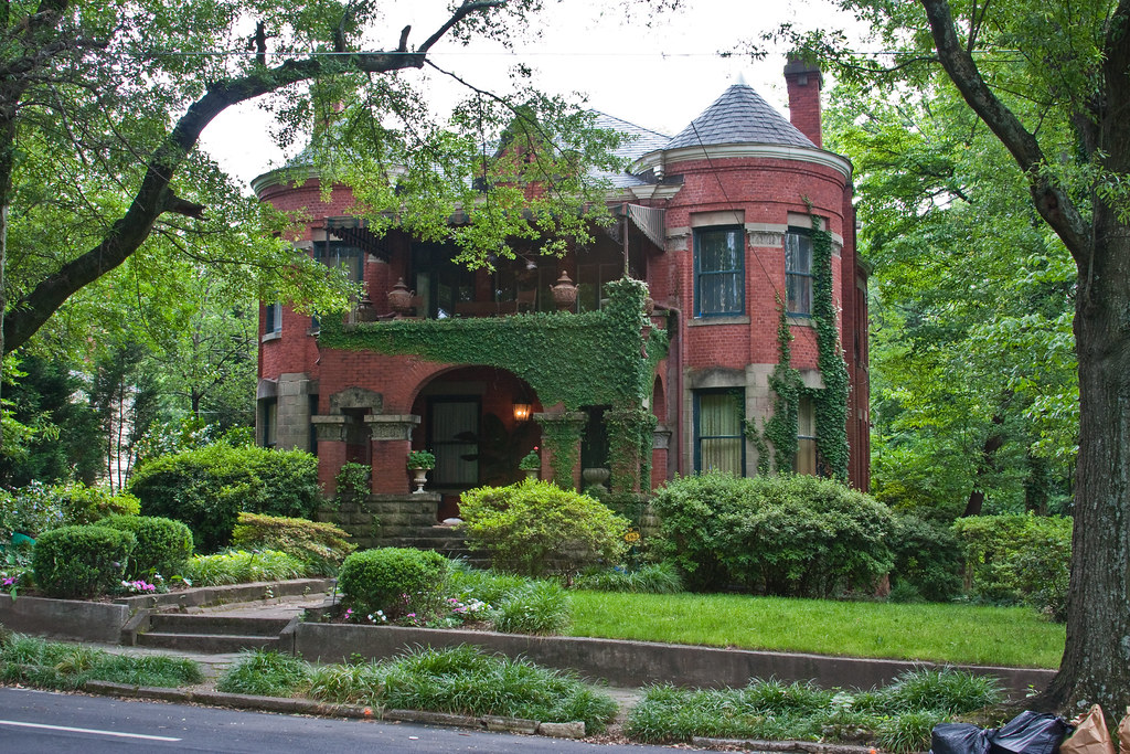
The Montrose area has bits and pieces that are similar to the urban street scape of Little 5 Points (L5P), but there is lots of empty land that can be filled in, side walks that can be fixed, and trees that can be planet for shade.
-
 1
1
-
-
This one reminds me of San Fransisco
-
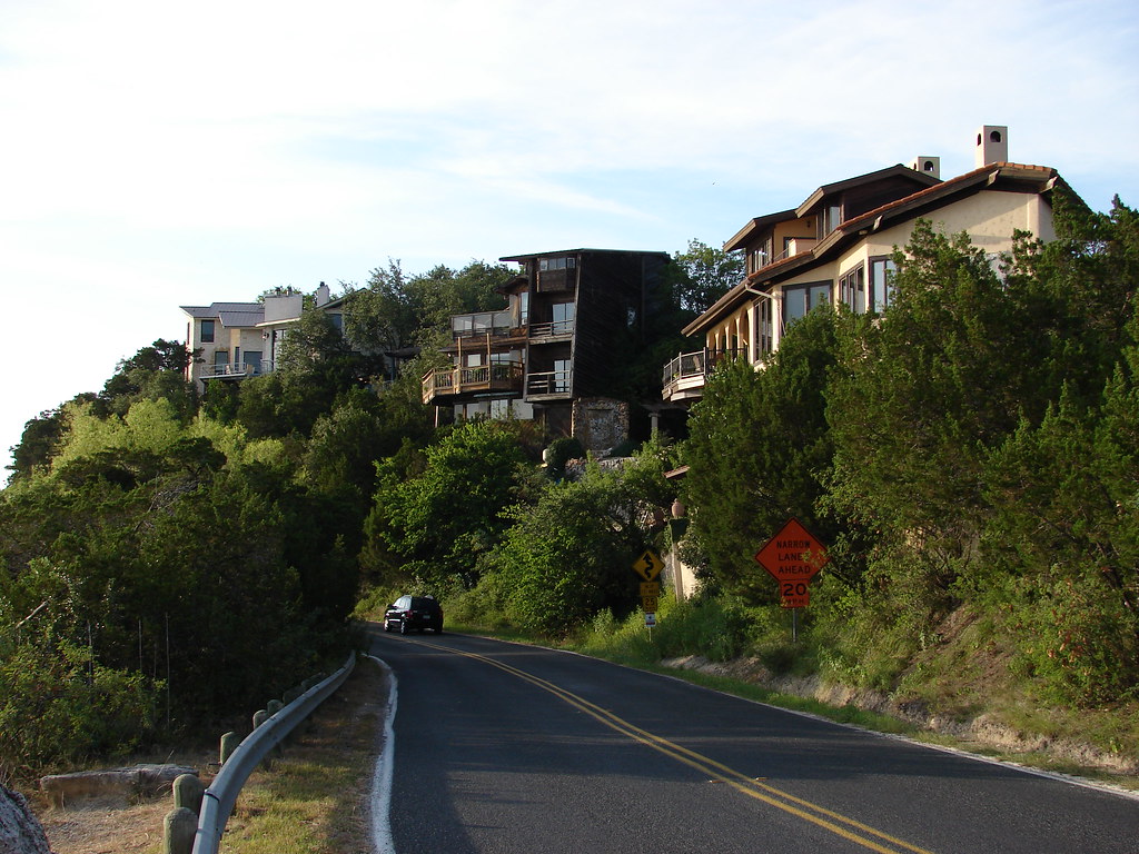
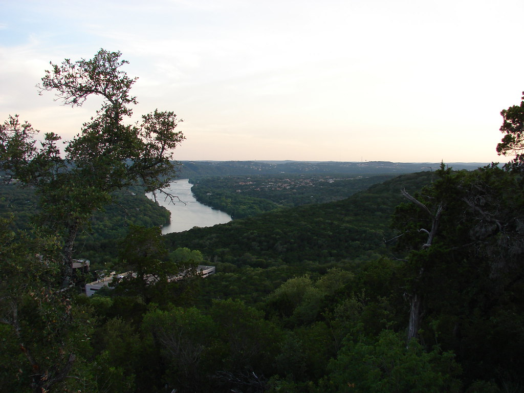
I decided to take the very very back way into central Austin from my mother's house. Much of this area is hilly terrain, although it is somewhat deceiving as the hills closest to Austin proper is actually a long canyon/escarpment. Central (flat) Austin actually sits at a higher elevation than some of the hills, so it is often the case that you drive down into them instead of up. It's almost a secret; you would never know there were large cliffs just a mile away from some of Austin's biggest freeways.
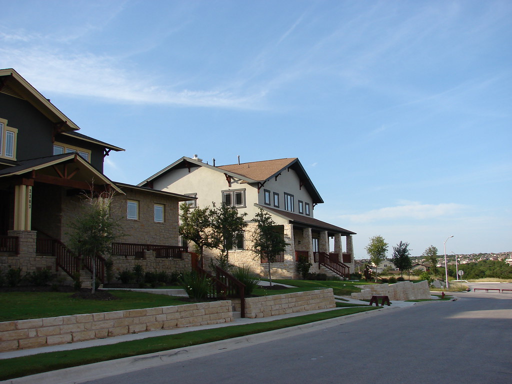
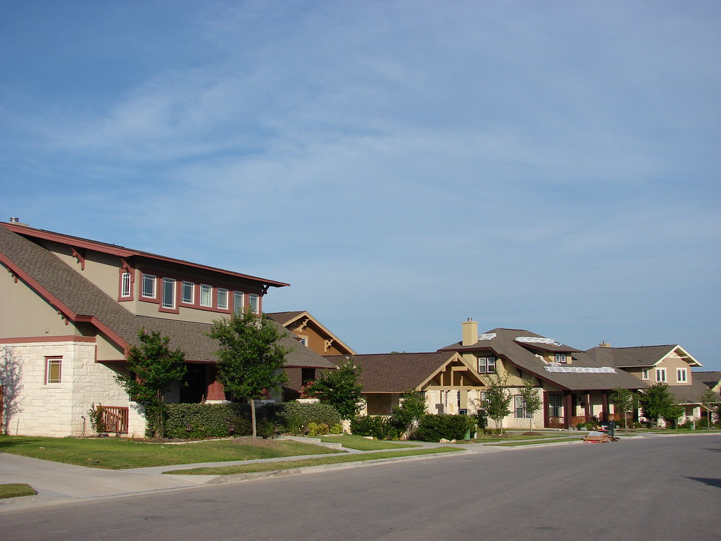
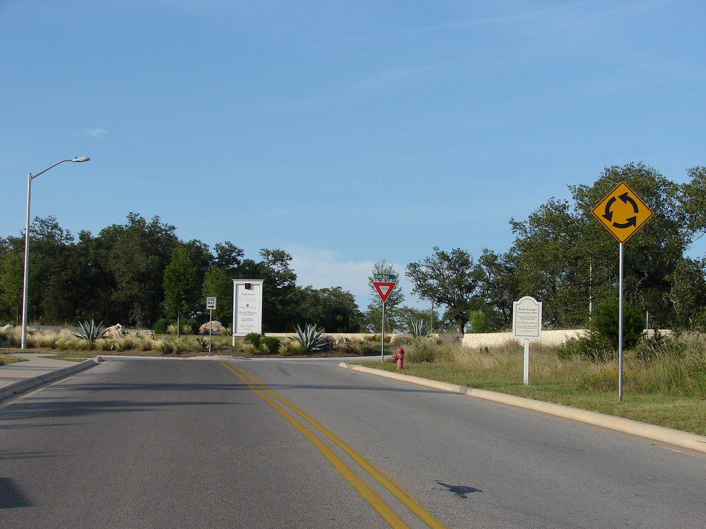
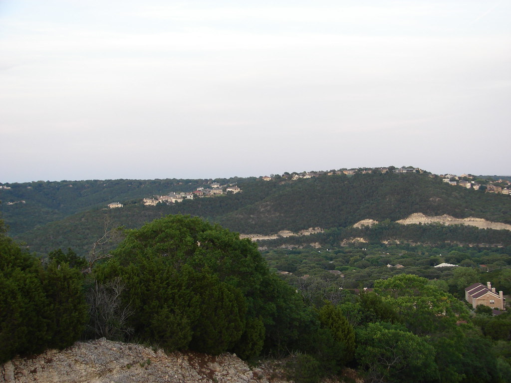
We'll start with the new subdivision near my mother's house - roughly 20-25 miles northwest of downtown. The quality of homes going up nearby are quite nice for suburban standards. They look quite different from the typical Austin tract house, at least to my eyes:
The sign says the houses run from the 300's-600's.
Roundabouts are all the rage in Austin suburbia lately:
If you notice the hilltop, it's quite flat. That's the plateau that much of the city actually sits on.
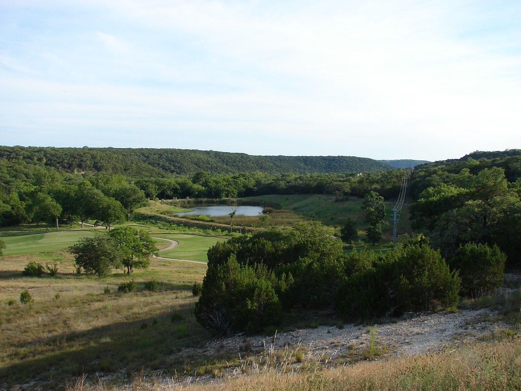
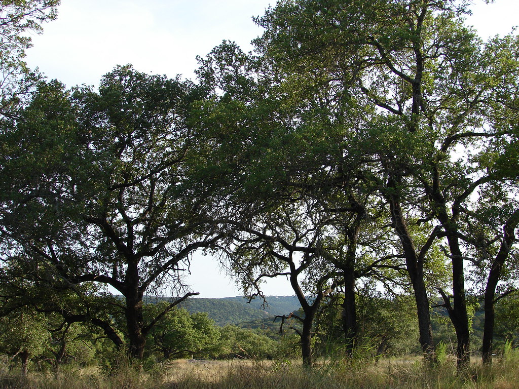
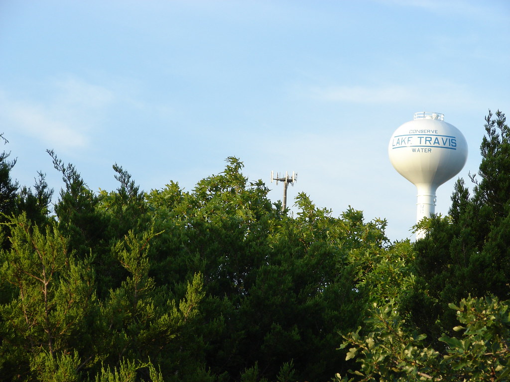
But down near the creekbed, the area resembles somewhere more leafier and east coast in origin. Generally the hilltops have mountain cedar (ashe juniper) and mesquite, with live oak and some other oaks mixed in, and the creekside areas or well-watered areas will have sycamore, cypress, willows, ash, etc. This is Volente Road, once rural but becoming suburban. It's a back road to Lake Travis, Austin's large recreational body of water.
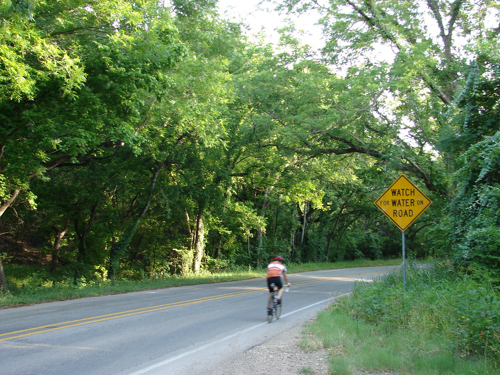
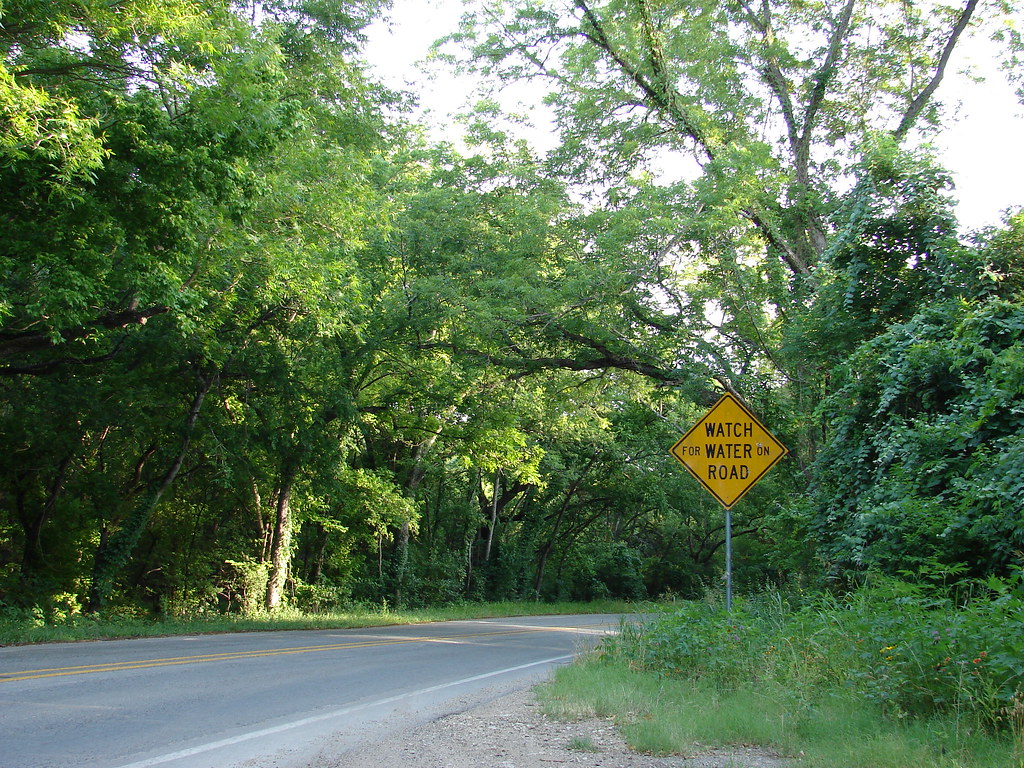
5 miles later:
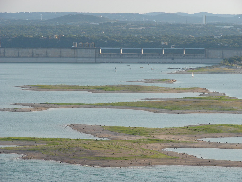
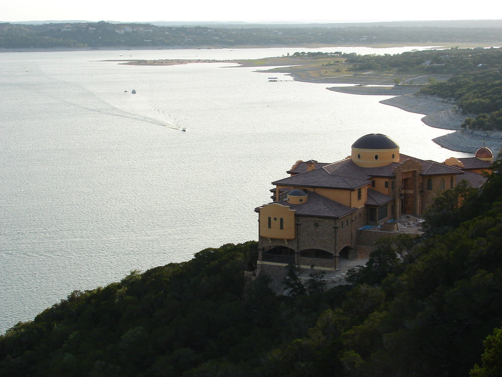
Lake Travis is one of Austin's main attractions, or at the very least an amenity to many Austinites. There is quite a drought going on, as the islands/sandbars that appear in the middle of the lake are not supposed to be there.
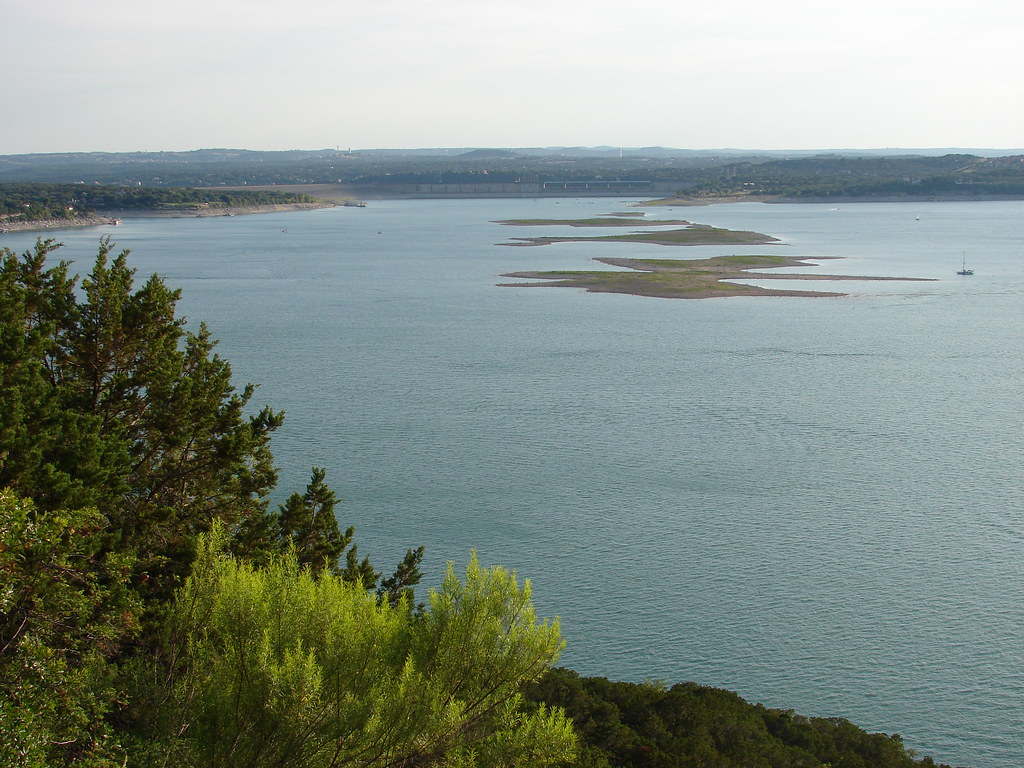
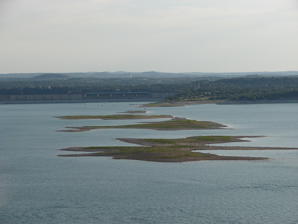
This is about 17-18 miles west of downtown Austin.
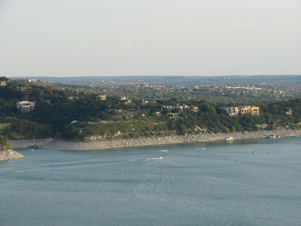
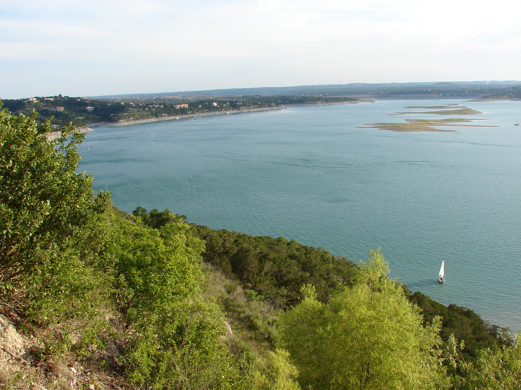

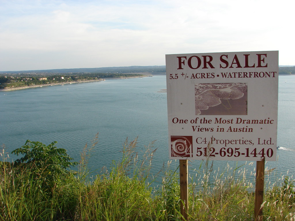
This is one of the few lots left with such a wide angle view of the lake, so I imagine it's million dollar property.
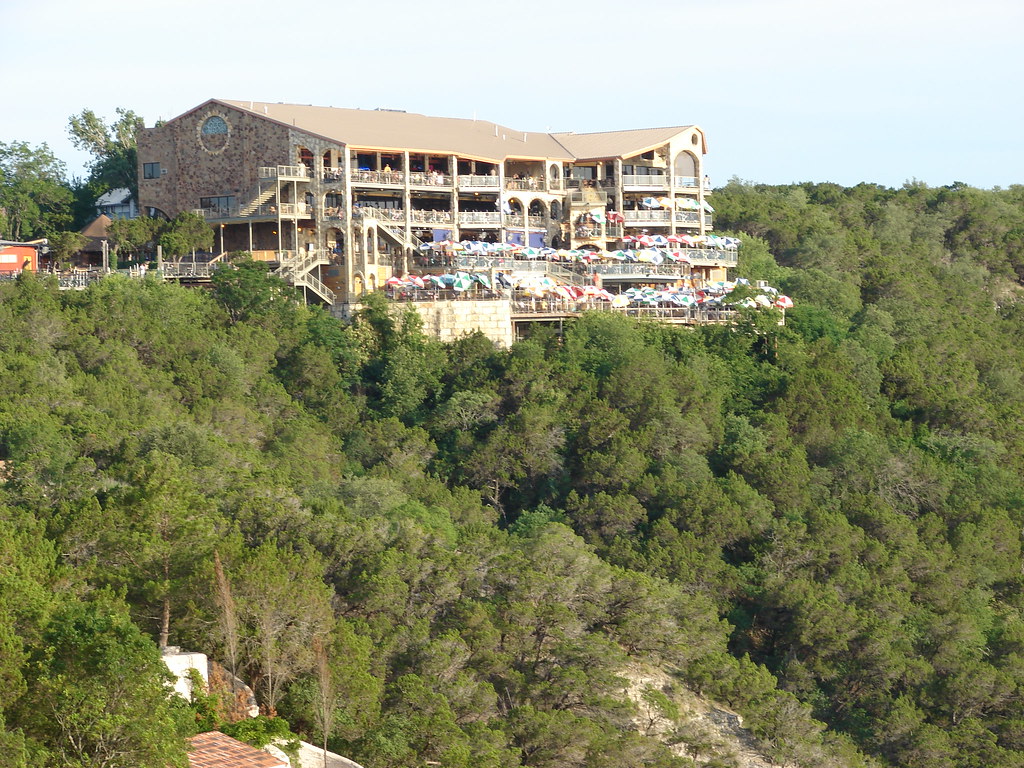
The Oasis restaurant is pretty much a local installation - it's a place you take out of towners for the lovely view, not for good food. Now the cuisine isn't all that bad, it's just a bit overpriced.
This captures why a lot of people are flocking to central Texas - ersatz Tuscany for the price of Dallas.
About 6 miles closer to downtown:
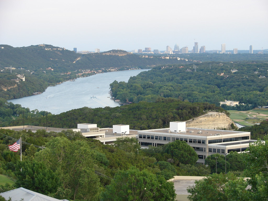
The exposed limestone is actually where Highway 2222 runs. It's only a few miles away from this angle, but you have to go down into the valley and back up to get to the road, so it's a lot farther in reality.
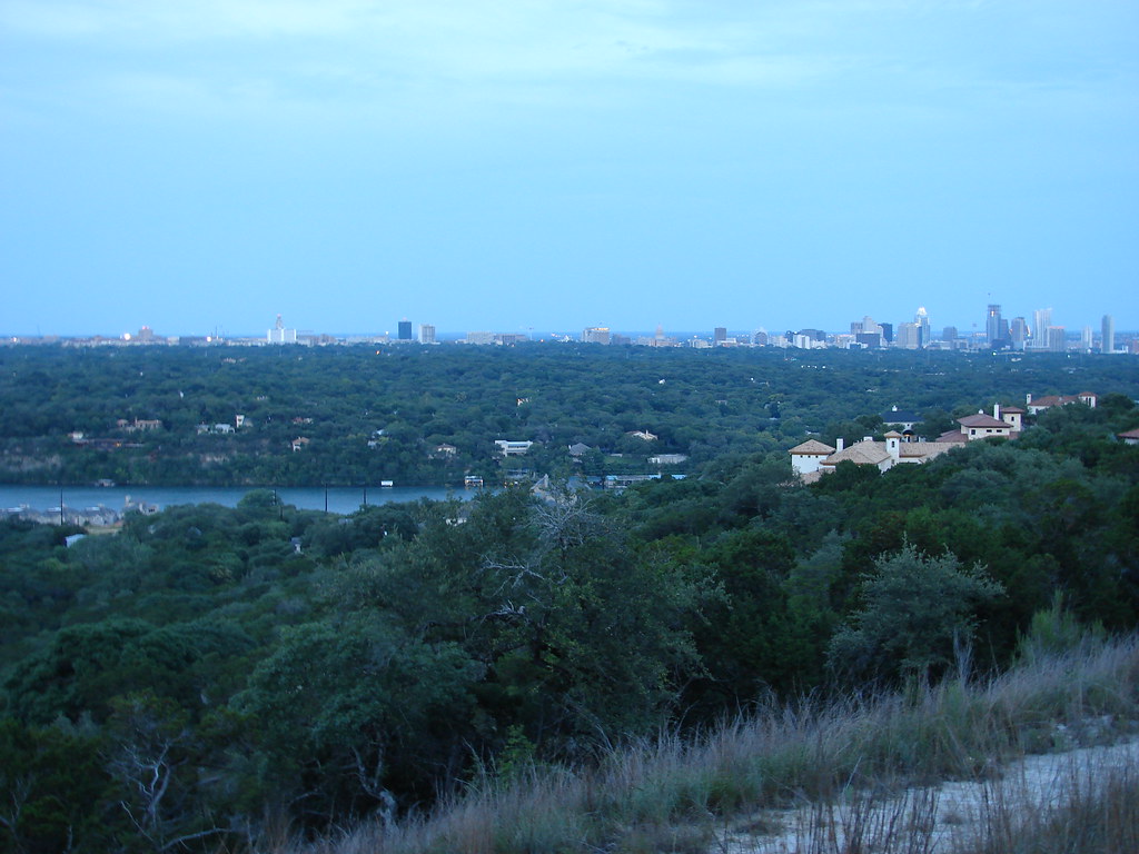
This is Lake Austin, which is just the part of the Colorado River that winds from Lake Travis to downtown Austin.
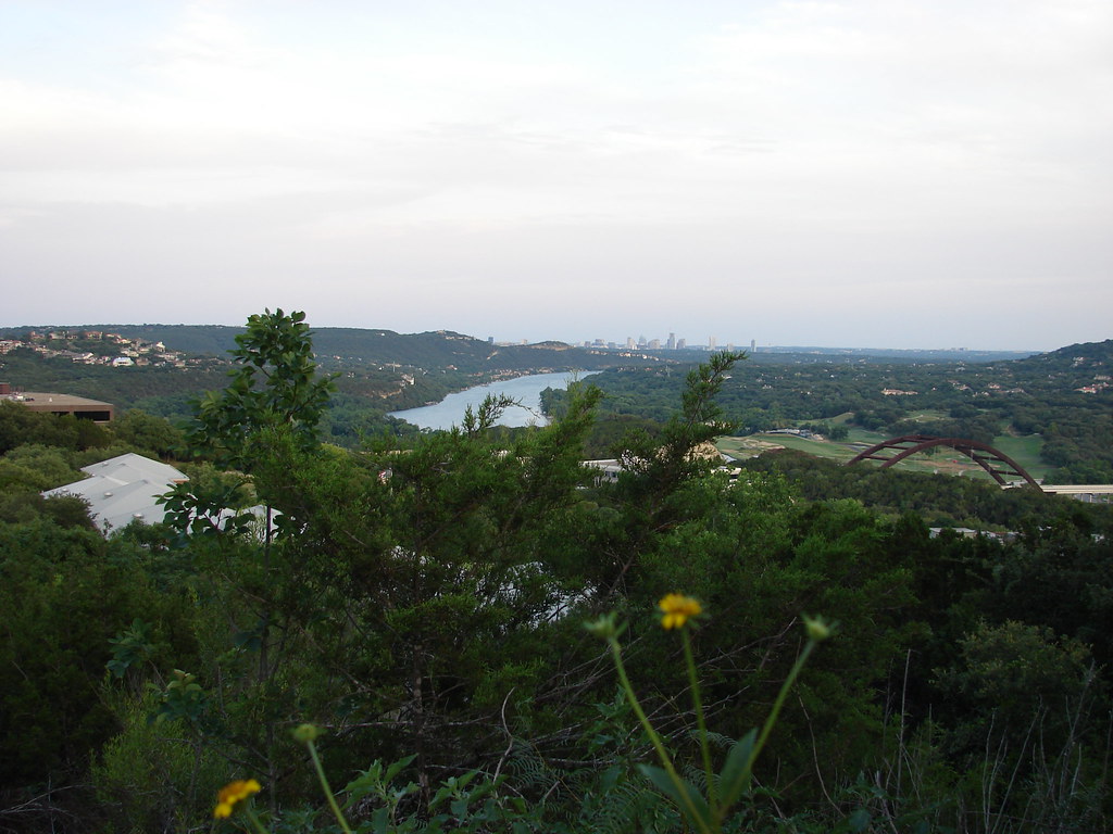
This is only about 4-5 miles away from downtown, directly west. This is one of the last lots of its type in the entire city, on Mount Larson Road. This lot by the way has remained unsold since I last visited it 5 years ago.
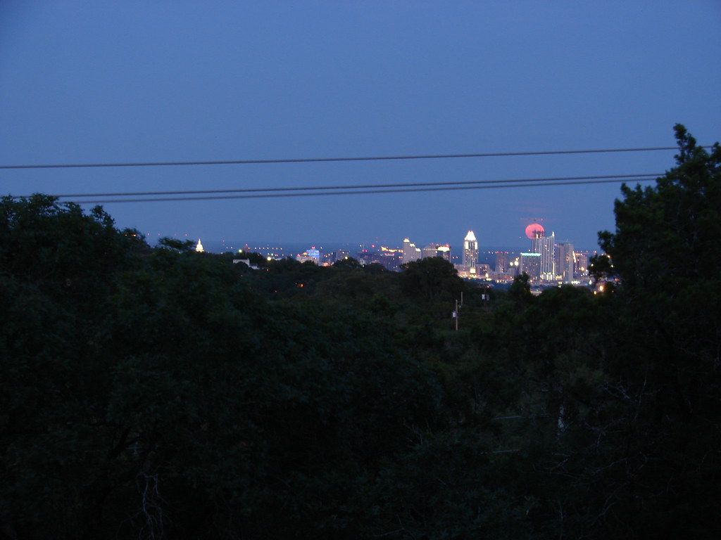
This is another unsold hilltop lot in Westlake with a good view of downtown. Notice the red moon over the skyline!
This is a good example to demonstrate how central Austin is actually higher in elevation than some of the hill country is:
This is from near Zilker Park, about 3 miles southwest of downtown.
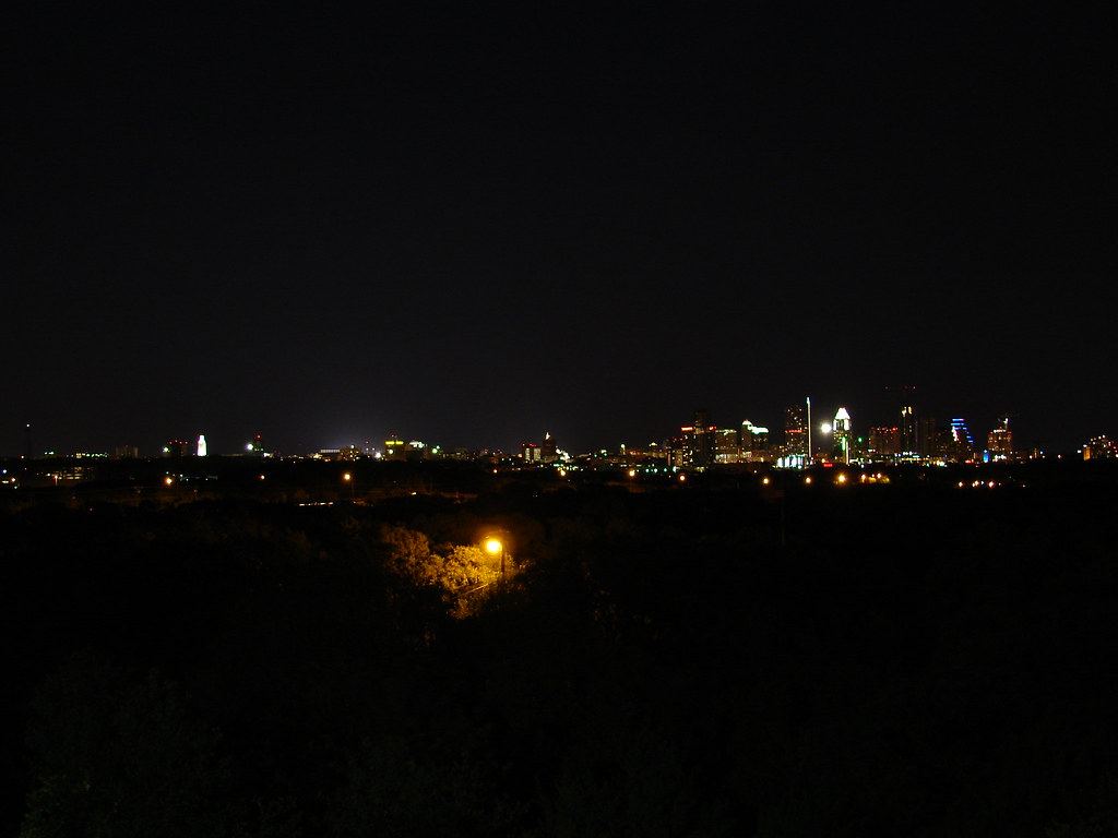
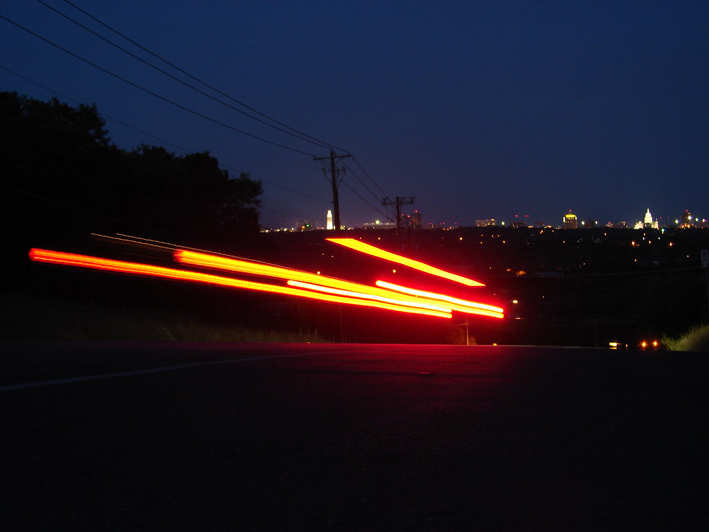
That was the very long, very scenic, very hilly back way to downtown Austin. This, by the way, is downtown Austin! I'm putting these here just so you can remember that it is a city (of some sort) we're talking about here.
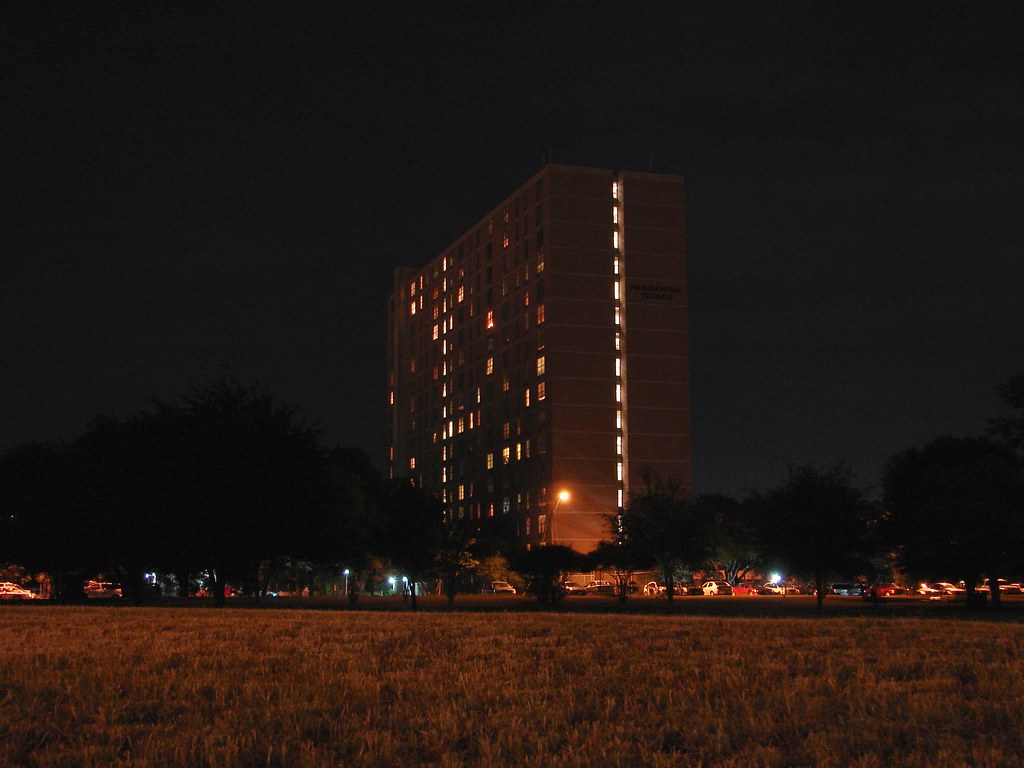
Also, to prove we're a real city, I will make sure to include a picture of our brutalist projects! Austin only has 2 of them, at least in high-rise form. This was formerly the RBJ Tower, named for Lyndon Baines Johnson's daughter Rebekah.
And that's the end.
-
guess the poster you copied from doesn't agree.
Now we're in Buckhead. Which, as it turns out, I no longer like.
Sick of the glorified office park that is Buckhead,
Yeah, but I'm sure if he saw the Uptown/Galleria area, he would be thankful for the somewhat urban Buckhead.
-
Continued:
Sick of the glorified office park that is Buckhead, I decided to head to Little Five Points, aka L5P. KingoftheHill keeps asking for shots from there, so I had to go by. I have friends on the APD, one of whom works this zone. His advice is the reason for the 1911. Though actually walking the streets, I got the impression that this area is more nice than some of the most secluded suburban gated communities out where I live.I started at the Inman Park/Reynoldstown MARTA station, headed along the route you see, then walked the reverse on the way home.

Homes in Inman Park.


The L5P retail district.


Downtown looming over L5P.

Back to L5P.


I'd take Little Five Points over Buckhead any day.
-
I believe both Uptown/Galleria and Montrose can learning something from both Buckhead and L5P.
I decided to hit up Buckhead and L5P today.Here is some Google Earth imagery of the locations involved. I got tired of sitting around in the suburbs, drove to Sandy Springs, rode MARTA down to Buckhead, walked around and took some pictures, headed to Little Five Points, took some pictures, then headed back to the suburbs. Took about seven hours. :haha:

First, some pictures from the Dunwoody MARTA station. MARTA recently changed their photography policy to prohibit only "commercial" photography. I came armed with a printout of their new policy (and a 1911).


Most of Sandy Springs is a glorified office park, but they do have these condo high-rises.


Now we're in Buckhead. Which, as it turns out, I no longer like. Sure, there are some nice towers, but like Sandy Springs it is not much more than a glorified office park. As you'll see, a lot of the buildings are set away from city streets by small parks. Also, many of the high rises have their own driveways that seclude them from normal city streets. There is no grid or anything. I hit dead ends and got turned around twice. Absolutely asinine. A small strip of Peachtree St looks like an actual city, but only until you cross north past GA 400. From then on, office parks and malls.
First is a Google Earth image of the route I followed. East along Peachtree up to Wieuca, then down to Piedmont, then up Peachtree to the MARTA station again.

Buckhead is funny. Back during the Jim Crow era, Mayor Hartsfield convinced Buckhead to join Atlanta so as to keep a white majority in the city. Now Buckhead wants to secede because they think Atlanta is wasting their tax dollars. I'm all about more local and responsive government, but the whole situation is just ironic.
Oh well. On to yuppie-ville.


Here is an example. The entrance to the Mansion on Peachtree. The entrance is secluded down a small street off Peachtree. Rather than an actual street, it feels like a col-de-sac. It dead-ends at some condos.


Turned back walking down Peachtree St.


That's the owner in the striped shirt. I ran into him picking up his wife and daughter after getting turned around by Phipps.


Headed back down Peachtree St.


This is the building I kept trying to get to but could not find due to asinine office park urban planning.


Oops! Not a street, just a driveway into a parking garage...

Back towards Peachtree.

At least with this shopping center, the parking garage is secluded behind the structure.

Go down this street a little way and turn left to park.

On Peachtree again.


Headed back down Peachtree towards the Terminus development.

Another example of an office park.

Look, I can see Downtown.


I heard the distinct sound of an Italian exotic, so I stopped to snap a few.


I didn't notice it at the time, but that is Bank of America Plaza poking up over there.


Office park...


Back towards the part of Buckhead that actually looks like a city.


When I was like twelve I watched a 4th of July fireworks display from the patio level of this building. One of my mom's friends lived there at the time. Now with 3344 Peachtree/Sovereign the view is pretty much completely blocked.


How many threads of different cities have you seen this exact building? I get the feeling I've seen this in threads of several other cities.


One of the Terminus buildings is in the center looming over a future restaurant at 3344 Peachtree.

See what I mean? On this side, though there are trees, shrubs, and other assorted greenery, the buildings face the street.

Looking back towards Mansion on Peachtree.

Terminus

Down Peachtree, another building that actually faces the street.


These buildings are a part of the Terminus complex. See how they face the street? Oh, and that one structure in the foreground in the center of the picture? That's a parking garage blended in with the rest of the buildings.


This shot is dominated by the parking garage.


On this side of Buckhead, it looks like they've tried to hide the parking structures.

The AJC ran an article on a lady who lives in this building. She purchased two luxury condos and a lake house during the boom and is facing foreclosure on her condo here. Yeah, I feel real sorry for a lady who bought two overpriced condos and a lake house at inflated prices.


Then I got mixed feelings looking at this. Did her property get foreclosed on just for someone to set up a gaudy satellite dish and replace their deck railing with particle board?


Final shot of Buckhead.

-
I would believe Target is looking at midtown. But I think that they would probably build their own two story building. They have urban Targets all over the US. Seattle has one, Atlanta, Charlotte, Minneapolis, and a lot in California.
Here is one in an urban development in Seattle: http://www.flickr.com/photos/21241102@N00/3291761118/
Here is a video of a two story Target
Wont the Whole Foods in Uptown be two stories?
-
We were looking at houses in Telfair (Sugar Land) a couple months ago and saw what must have been these two. Two little people were walking out of the David Weekly model home trailed by a film crew as we were walking in. It was rather surreal - but the weird part was seeing the guy climb into the driver's seat of an otherwise normal looking SUV and drive off, followed by the crew in a second vehicle. I'm sure the car had some kind of special modifications on the inside for him to drive it, but it was certainly bizarre to watch from the outside.
The David Weekly saleslady said it was for a "TV show," so now we know what it was.
I think they showed that episode last night.
-
Cracker Barrel is coming to the center: http://gis.bryantx.gov/public/SDRC/2009%20...try%20Store.pdf
-
I heard that we are move towards a national driver's license/id and license plate in the near future, so it won't matter for long.
-
I actually like the bland California plates and the older white Louisiana plates. I guess I just have to see how these look in person.
I agree with the placement of the 7 characters though. I don't know why they don't do XXXXXXX instead of XXX-XXXX.
Everything you said I agree with. I like the California plates. And I was wondering the same thing about the XXX-XXXX.
Aww man, c'mon, don't tell me you don't know what that reference is from?!Batman. But where did that come from. I looks like its real.
-
I like it better than the old ones. They should have done the license plates with Texas written like that.
-
I'd rather have one of these:

City of Gotham? What counrty is that plate from?
I Voted for the one with the skylines at the bottom. They were all ugly. Why does everything in Texas have to be the generic RED, WHITE, and BLUE? I know there our National colors, but can't we come up with something else? Same goes for Houston Sports Teams (except the Dynamo and the Hockey team).
-
1
-
-
Sorry, but the idea of hiking down into a subway station that most likely wont be air conditioned doesn't thrill me. I've ridden the subway in Boston when it was only 85 and about half as humid as it is here and those stations can get really uncomfortable. In NYC, it's even worse. On a hot August day with typical Manhattan mugginess, it's downright rank in the tunnels. I can't even begin to imagine what a Houston station would feel/smell like...
Additionally, I'd wager that most people would feel safer at a street level station at night than having to deal with stairs/escalators/elevators in the dark.
Of course, all of this is moot since we DON'T HAVE THE MONEY!!!
If I remember correctly, the subway stations in Atlanta were air conditioned. I'm sure the newer subway systems across America are.
-
You mean the building in this picture? The one that's already done?
I posted that picture to get a better understanding of how the area would look. I knew that that was already built, I have seen it in person enough, I was talking about the building in the rendering with all of the billboards.
-
Okay, now its all coming together. I know exactly where this is now. When all of this gets built this is going to be a nice area. So when exactly will the tall building get built?
-
No, the rendering appears to be on the northwest corner of Elgin/Louisiana, opposite the 24hr Fitness. (See downtown in the background.)
So is the 24 Hour Fittness on the right where the guy on the bike is in the rendering? The building on the left is brick, and the other building on the far right (distance) seems taller, so it must be out of site of the rendering??? Correct?
-
Can someone tell me, was this below.........
(continued) supposed to look like this?

-
To clarify and correct cityKid (who, to nobody's surprise, misread the linked article), only one street has been closed and turned into a pedestrian mall: Broadway, from 42 to 47th streets.
Well I did not read that particular article, I just found an article on it to share with you all. from what I read earlier, only on street in the Times Square area was closing off a section. But this street was closing off 2 sections total, one section is in another busy square that is not Times Square.
-
what and where is LA Live? Dallas?
In LA. Its LA's version of Times Square.
Victory Park:
I wonder if they could modify the whole area so that people could see it better and get to it easier? I thought it was a bad design when I first saw it. The should have taken a look at Times Square before building it the way they did. All off the billboards should have been on the street where people could just walk and drive by. It would have been much more successful if they had designed a street similar to the way Times Square splits, and added large high and midrise buildings high dense all through out. Then sell add space on all of the buildings. It could have been much better than Times Square in my opinion.
By the way the Times Square area now has a few of the main streets in the area permanently closed of and turned into pedestrian malls. I saw it on the news earlier this week. So the way that we a use to seeing Times Square with cars on both sides of the median of buildings is no more.
http://www.post-gazette.com/pg/09151/97343...d=lifestyle.xml
-
Here's a picture of Manor East Mall before the "mall" part was added to the left (east) of Monkey Wards:

Is that Kroger where Hastings is now? If so I don't remember that building behind it. Is that where Whatabuger and the other places are now along Texas Ave?

The "To Do List" for the City of Houston
in City Hall
Posted
Houston is the fourth largest city in the United States has an abundance of problems. From the dated city streets (potholes), to the huge littering problem and the unattractiveness of many of the city's main corridors, many issues exist. So what do you want the next mayor and other city leaders to focus on?