

DJboutit
-
Posts
73 -
Joined
-
Last visited
Content Type
Profiles
Forums
Events
Posts posted by DJboutit
-
-
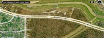
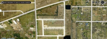
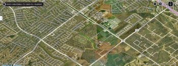
4 Abandoned apt complex Inwood Forest Antoine Dr between west Tidwell and west little work
Candelight trails 5600 De Soto now a empty lot
video before it was taken downCandelwood Glen 5399 Desoto they are still there they have not been take down yet
http://swamplot.com/open-houses-in-candlewood-glen/2008-06-02/
Gables Of Inwood 5600 Holly View Drive now a empty lot
http://abclocal.go.com/ktrk/story?section=news/local&id=7942084
http://swamplot.com/city-shuts-down-gables-of-inwood-park-memorial-condos-next/2008-07-30/
Oakbrook 5353 De Soto have not been taked down yet
http://www.khou.com/news/Northwest-Houston-residents--want-abandoned-buildings-torn-down.html
http://www.nearnorthwestdistrict.com/Programs/Abandoned%20Apartments.shtml
-
West of 45 South Of Blue Bell Rd from Marek St to Tamara most of the homes are gone I am guessing everyone left after flooding from Allison neighborhood backs up to a bayou and 2 ponds
2002 aerial map all homes are there
No idea yr most homes are gone
Google street view Tamara only 1 house left and 1 stripped sell house the rest are gone
Google street view 2 Dorita 2 homes standing 1 mobile home 1 stripped shell house
-
4 Decent size empty lots in a row south of Cavalcde from Evelyn St to Malvern St Elysian St to Maury St these lot back of to the rail road tacks
1964 aerial map

No idea yr of this image
Google street view
Street view 2
-
3900 Hoffman and Crane just off Lockwood in the 5th ward 25 small row houses
http://www.khou.com/news/Abandoned-Apartments-Complaint-132115308.html
-
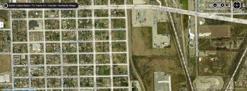
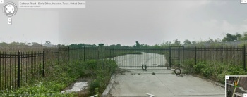
Gated town home complex that was never even built I guess that released there was to much crime in the area. You can drive and see the fence and the rectangle street
No idea yr of aerial map
Google street view
-
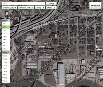
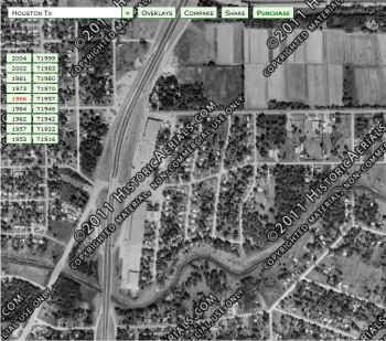
This neighborhood is slowing dying you can see it over time there use to be a lot of small homes and apts complex in the area. Warehouse flood crime are the reasons why a lot of people left East of 59 from Jensen Dr to Bayou St
1966 aerial map you see there is empty space in neighborhood and how small most of the homes are
2002 aerial map a lot of people have left
No idea of yr you can see a lot of new town homes
-
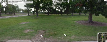
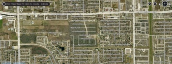
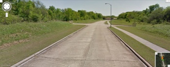
Here is a decent size neighborhood that was planned but never built West Bellfort and Penmbridge dr south to Ludington Dr
Aerial map no idea yr you can see the proposed street that were never build weird
Google street view you can see the street that planned to be built off of Ludington but never really build
Street view 2
-
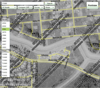
Small apt complex or town homes looks like a flood moved everyone one Airport and Mur way about 4 blks east of Cullen. You can still see the homes when you drive west along Airport they back up to Sims bayou you better look quick or you will miss them there are lots of trees and trash now it is a dumping ground and crime area
1981 aerial map
No idea the yr of this aerial map
Google street view
-
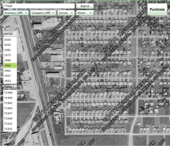
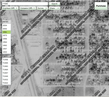
This neighborhood is slowly dying you can see it over time South Of Long Dr West of South Wayside. Maybe the warehouses along Mykawa are the reasons why a good number people left this neighborhood
1964 aerial map all the houses are there
1981 aerial map a lot of people have left
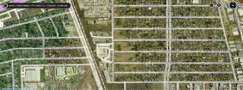
No idea the yr of this aerial map more people have left
-
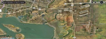
There is a area that use to house mobile homes that might have housed people after Allison not really sure Almeda Genoa and Pembroke just east of Cullen
2002 aerial map just yet just a open field
2004 you can see all the mobile homes
No idea when this one was talk half of the mobile homes are gone this looks to be about the time people starting looting them and steaming all the copper and other stuff people could sell
-
Halls Bayou from Shady Ln to the other side of 59 to Willie st
West Of 59 South of Halls bayou
1966 aerial map
2004 aerial map everyone has left after Allison there are only a few streets that back up to Halls bayou
East of 59
1966 aerial map
2004 aerial map everyone has left after allison
-
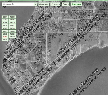
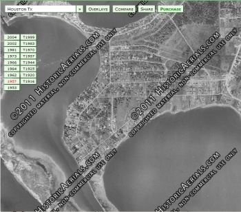
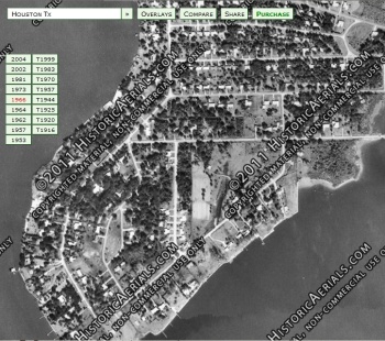
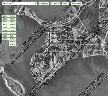
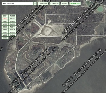
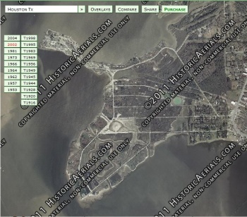
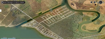
Brownwood now the Baytown Nature Center
1957 aerial map
1966 aerial map you can see the very south tip is now under water
1981 aerial map about 3 yrs before everyone started to leave
2002 aerial map everyone has left
-
Anybody know of any abandoned neighborhoods and why they are abandoned
Knobcrest and I45 just north of Greens Rd along greens bayou I think there is a thread about this neighborhood here
Brio Superfund site Beamer and Sawyer Rd everyone know about this neighborhood
Tri City Beach Rd and Coral Crest right next to Ceader bayout and Bay Oaks Harbor just south east of Baytown I need more info on this neightborhood
-
Fondren Southwest had has problems with coyote's trappers have caught 9
http://edition.pagesuite-professional.co.uk//launch.aspx?eid=aa82a2bc-2537-4f82-9570-0225313f4a79
I have seen dead Armadillo and Skunks along the side of the road South Post Oak between South Willow and Gasmer where the Willow Water Hole park is
-
It is now a www.viethoa.com name L O L
-
There use to a siren horn on Cliffwood right across from Red Elementary next to the neighborhood pool where the private school is now. The siren horn would go off ever Friday at 12pm for testing this was for a warning if we ever when to war with Russia when Russia broke up in to small countries in about 1998 to 2001 this siren horn was taken down I think this is what you were hearing. The siren horn was on top of a 65ft to 100ft telephone pole
-
 1
1
-
-
I live only 4 blks from that Randalls is it the most ripoff grocery store chain I like HEB a lot more
Everything they sell is about 30% more than any other grocery store
-
I remember there to use to be a Mcdonalds on Stella Link just south of south Brasewood it was the only one for like 2 or 3 miles when it closed it turned it into a Specs the building was torn down like 3 or 4 yrs ago
Across the street the from the Mcdonalds next the Shipleys use to be a Pizza Hut at the time it might have been the only one where you could go in and sit down now it is Wild Kitchen they might have the best burgers & fish n chips in town
-
^^^ That video does not even show that bridge the video started at about 610 east & 59 north & went to 225 then east on 225 I never saw this bridge. The funny thing about the video the driver is doing about 85mph I know the video was speed up about 5 times
-
Memories for the area just out side the loop in zip coeds 77096 77035 & about 1/3 of 77025
I remember before the walmart south Poast Oak & 610 was built in the late 80s to early 90s there use to be a golf course there.
Where the Krogers South Post Oak & West Bellfort is now there use to Beldens which is now at Chimeny Rock & North Brasewood. Behind the Beldens use to be a drug store do not remember the name they sold hamburgers.
Where the Cabana Carwash is now there use to a putt putt miniature golf
Next to Beldens just south there to use to a AJ Foyt car dealer there
Right after AJ Foyt closed behind where the Meyerland car repair is there to use to be a place that sold 4 wheelers & dirt bikes it burnt down
Right next to the Meyerland car repair is now a Day care to use to be a restaurant do not remember then name they use to serve home style food the drinks were served in mason jars
South Post Oak & West Bellfort right next to the chase bank use to be a cafeteria do not remember the name
About 150ft down from the cafeteria there use to a small green auto repair shop it was torn down but the foundation stayed till about 5 to 7 yrs ago
There use to a BBQ restaurant on Omeara about 1 block from south main next to the ghetto carwash now it is a place where they park ambulances
West Bellfort at the rail road tracks between Cliffwood & Stella link there is a big warehouse it is now used a band rehearsal where you rent space I have no idea what was there originally
Murworth & Buffalo speedway where the town homes are now there use to be a strip shopping center with Loma Lind mexican restaurant
Stella Link & 610 where the discount tire is now there use to be a Jack N The Box
Stella Link where Work Force is now in the same shopping center there use to be a Crown book store one time in the mid 80s I was with my mom we were just out to leave my mom working out the fronu door & a mexican guy was be chased by the police mom was only about 5 to 7 ft from this guy
Willow Bend on the Wast side of the train tracks where the baseball field about 5 to 7 yrs ago their use to be a place that sold plants there still is a old brown metal building that still stand
Craig Head & Willowbend right next to the train tracks next to Carolyns bar there to use to be a Firestone
South Main & Willowbend there use to a golf course wierd thing about it it was so close to the street bet a few times people driving by got golf balls through there window
-
1
-
-
I remember waiting in line waiting at the bridge for the movie theater to see Superman I or was II I can not remembers I was only like 4 to 6
-
I use to have a old Houston street map from the early to mid 70s and the map showed 2 more streets in willowbend post oak manor. These 2 street were the next 2 street south of warm springs where the private school is now. Where there really 2 more street south of warm springs if so what where the names of these 2 streets & happened to them. On the big field where the school is now what use to be on this site? I am looking for old picture of this field if anybody have any thx


Abandoned Neighborhoods
in Historic Houston
Posted
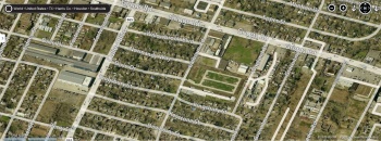
More apt complex in the Inwood Forest area
Inwood Oaks 3902 west Little York Rd they have not been taken down yet
Town Home Complex run down these do not look that old really W Little York and Inwood Park look to be about 40 units