

sinister1
-
Posts
174 -
Joined
-
Last visited
-
Days Won
1
Content Type
Profiles
Forums
Events
Posts posted by sinister1
-
-
The neighborhood is known as the First Ward, the Park it's self was Luna Park.

-
 2
2
-
-
I've always wondered why residents of the Independence Heights call it or refer to it at Studewood. As far as I know Studewood ends in the Sunset Heights area. While looking this up I found some information from the 30's and 40's that once you crossed 31st street that area was know as N*^*er Town back then. I was wondering if maybe back then before 610 if Studewood went on into Independence Heights
-
Here's a few more you might remember.
-
Here is a pic.
-
1
-
-
I was watching a news report where they showed a short film about Alief today; it's mostly African American now and is being overrun by gangs; the new locals call it "The West". It's a shame how a nice community or neighborhood can go trash with the gangs and drug deals and all.
-
The one on Crosstimbers...that's the one I remember!
Yes the one on 11st is right next to Hogg Middle School and across from Andy's cafe. The building is still there but soon to be lost forever. I remember it operating until sometime around the mid 80's.
-
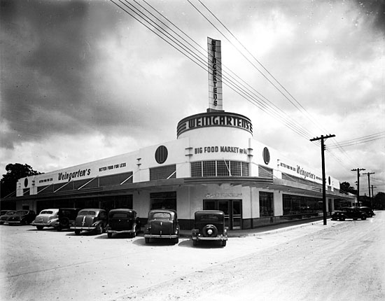
I grew up in Westbury 1958-1965, and watched the Weingartens next to Westbury Square being built. My mom used to send me to the store to get her a carton of Chesterfield's for $2.00 and they had the two water fountains and the two sets of bathrooms in the front of the store that were the way of the times back then. I'm not sure what it is now. I remember finding several cases of out of date wine in the dumpster behind Weingartens that ended up getting me in a lot of trouble. Had a lot of fun at Westbury Square also. I remember filling up a balloon with dish detergent and sneeking it into the fountain next to Rumpleheimers and breaking it under the water, and seeing it mentioned in the Houston Press the next day.
I better shut up!
Cool, do you have any photos you could share px4man?
-
I love that bldg. on Wash. Ave. with the black tiles, that really needs to be preserved. What was originally next to it, looks like another store connected.
It was an Eckerds drug store back in the until like the early 90's ;-)
-
Boy Downtown has changed some!!!
And it's going to change again if they go ahead and go through with the expansion of 45. : (
-
Does anyone have pictures of the old Weingarten's on Yale?
-
-
Holy Crap, the one on North main is an Oriley's Auto parts now. The building looks like it's from the 30's or 40s.
Here's the one on Washington Ave. Looks like Oriley's bought this one too some time back, it's some kind of Sushi place now.
-
1
-
-
I remember going to a Weingarten's in Gulfgate Shopping City. The was a toy store just down from it.
Holy Crap, the one on North main is an Oriley's Auto parts now. The building looks like it's from the 30's or 40s.
-
Here is a later photo of the newer building from the 70's
Here it is today.
-
Here's a picture from around 1930, this is off of Quitman and Fulton where Fiesta is now, it was remolded sometime after to what it looks like now but I don't know when. Fiesta bought the building like in the mid 70's or early 80's (don't remember) when the original Fiesta off of Fulton was burned down during the Moody Park Riots.
Here is a later photo of the newer building from the 70's
-
Does anyone have a photo of Weingarten's grocery store showing their sign?
Here's a picture from around 1930, this is off of Quitman and Fulton where Fiesta is now, it was remolded sometime after to what it looks like now but I don't know when. Fiesta bought the building like in the mid 70's or early 80's (don't remember) when the original Fiesta off of Fulton was burned down during the Moody Park Riots.
-
From 05-15-1892
Names of Streets Changed
By a recent act of the city council the following changes have been made in the names of streets, the names generally being after some one prominently connected with the present or past of Houston:
Wards First and Fourth north: Bradley to Sabine street, Heiss to Colorado street, Stanley street to Stanley place, Park to Johnson street, Nicaragua to Moore, Bismark street to Bismark place, Clay street to Houston avenue, Susan to Kessler street, Cushman street to Cushman place, John to Hickory street, South street to Artesia place, Herbert street to Herbert place, Kane street to Reisner street, Morin street to Morin place.
Second ward: First street, Factory addition, to Lockhart, Second street to Bering street, Third street to Kennedy street, Fourth street to Fox street, Fifth street to Dumble street, Sixth streed to Freund street, Seventh street to Foley street, Clarke street to Flynn street.
Third ward: West Broadway to Hutchins street, East Broadway to Dowling street, Shanghai to Velasco street, Bremond street to Burke place.
Fourth ward south: Bomelt street to Baldwin street, Trinity street to House street, next street west of Trinity to Fuller street, Sabine street to Heiner street, Bayou street to Crosby street, Hobson to Meyer street,Baker to Buckner street, Gentry to Sherman street, Runnels to Cushing street, First street west to Mathews, Second street to Wilson, Third street to Bailey, Fourth street to Gilette, Ennis street to Ruthven, Cline to Cleveland street, First street south to Arnold, Second street south to Cook, Third street Sutton, Center to Erichson street, Houston to Curtin street, Laura street to Rusk avenue.
Fifth ward: Henry and Johnson streets from Webster addition east to Clarke street, to Campbell street, Pascal to Leo street, Campbell to Noble, James street to Sumpter street, Grand avenue and Stephens street to Loraine street, Pinkney to Wills street, Dumble street change to Leona street, Price and John street to Opelousas, Venice and Burr to Liberty street, Second and Bull to Sterrett, First to Grayson street, Ducong and Hare to Nance street, Waverly to Brooks street, Stephens to Hogan, John street Richey addition to Walnut street, Mariana to Huntington, Walker street to Willaimson place.
Hi,
I would like to know where did you find this article? I have not been able to find any maps showing Houston Ave. as Clay St. I went as far back to an 1887 map and is shows up a Houston Ave. I would be most grateful if you could share the source of this information. Thanks.
-
West (and East) Montgomery was a rather informal name. Airline was also known as East Montgomery after it joined up with Fulton going north. Going south, East Montgomery followed Fulton to downtown.
As for West Montgomery, it followed Yale after meeting with Tidwell, down to Whitney and then a dogleg over to Main where it went to downtown.
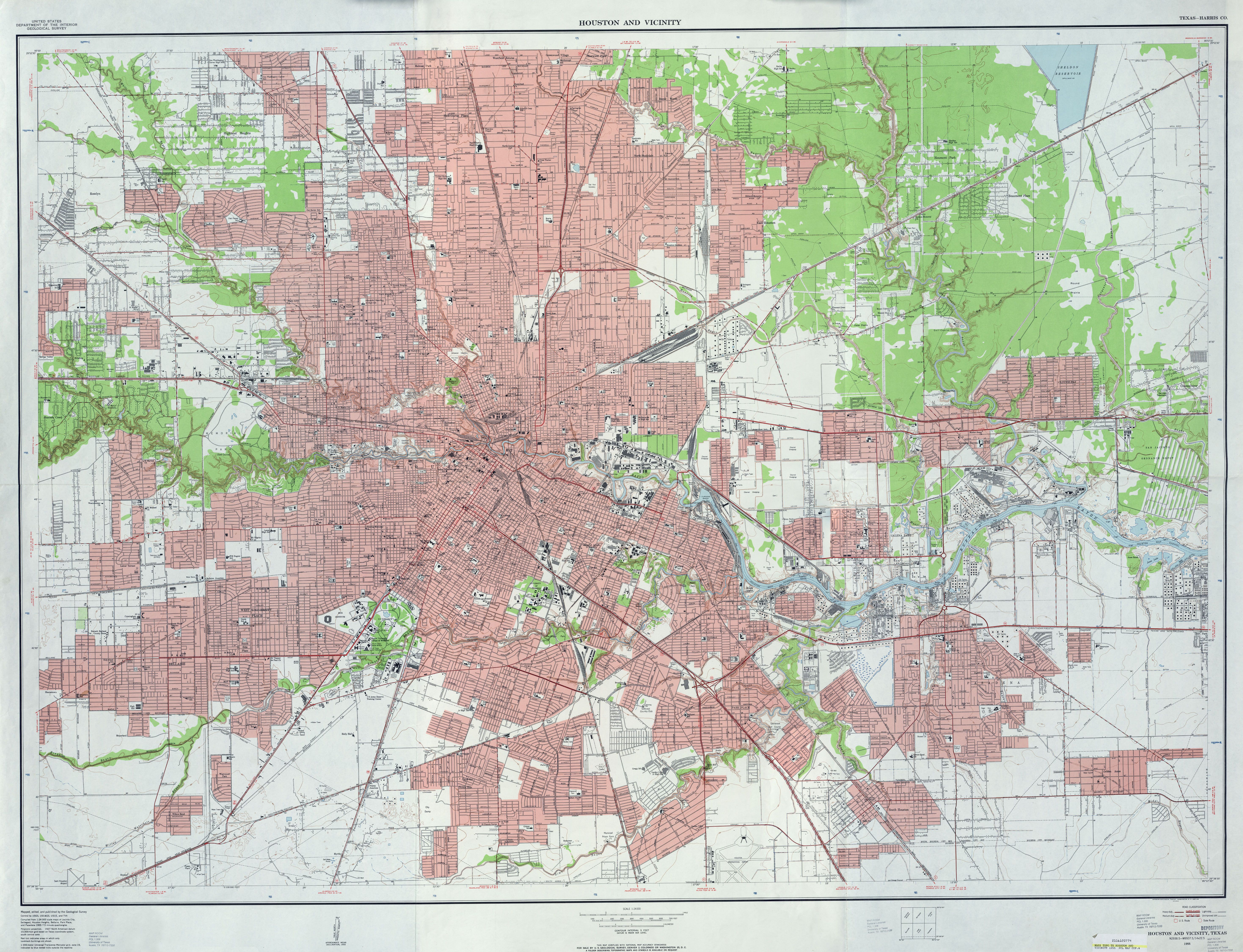
http://www.texasfreeway.com/houston/historic/road_maps/images/1955_houston_humble_highres.jpg
I believe that once you got into "town"... that is, you passed Tidwell, neither of those designations were really used, other than on maps. As far as East Montgomery Road, I don't really see any references to it in phone books after the 1930s. As far as West Montgomery Road... if you were on North Main, I don't think anyone other than the mapmaker called it West Montgomery. It was more of a route name, if I understand it correctly. One road was the way to eastern Montgomery County, the other was the way to western Montgomery County. That's the way I've interpreted it. If I'm wrong, I'm sure someone will correct me.
Here's a few more maps. They're pretty inconclusive:
1913:
http://www.tsl.state.tx.us/arc/maps/images/map0435.jpg
1935:
Wow W.Montgomery running down Yale st. explains why there is an old Yale st. Probably after they renamed that section of W. Montgomery to Yale they changed it. Cool
-
The Shepherd Street bridge over White Oak Bayou used to have a plaque calling it Erie Street Bridge. The plaque disappeared when they rebuilt the bridge. I have a small hope that someone takes those and puts them in a warehouse somewhere for posterity, rather than just junking them.
I seem to remember seeing that plaque; was it the smaller bridge? If I remember correctly this was before they built the bigger brige that goes over the railroad tracks where the Houston Car Auction use to be. Is this right?
-
The link above takes you to a Map from 1913 which shows the Turner addition with the Chestnut and Sycamore streets clearly labeled running vertically but notice that the streets that run horizontal are blank, these are the number streets. My guess is that they are blank because they haven't came up with new names for them but I could be wrong.http://www.tsl.state.tx.us/arc/maps/images/map0435.jpg
http://www.lib.utexas.edu/maps/topo/texas/txu-pclmaps-topo-tx-houston_and_vicinity-1955.jpg
Okay this 1955 Map shows 11th street as Bissonnet, so somewhere in between 1913 and 1955 the names of the streets changed. Maybe like Ross mention it was because it was annexed by Houston and the Heights already had similar names or because of re-construction due the building of freeways. It would be very interesting to find out.
-
Ross, thanks so much.This is a bit of Houston history about which I'd never heard.
Could it be that the numbered streets were renamed so as not to be confused with the numbered streets in the Heights?
http://www.tsl.state.tx.us/arc/maps/images/map0435.jpg
The link above takes you to a Map from 1913 which shows the Turner addition with the Chestnut and Sycamore streets clearly labeled running vertically but notice that the streets that run horizontal are blank, these are the number streets. My guess is that they are blank because they haven't came up with new names for them but I could be wrong.
-
Actually Old maps show West Montgomery Road going way past the Shepard/Tidwell intersection area. It ran from the banks of Buffalo Bayou where the University of Houston sits now and ran the route that North Main runs now. North Main now ends on West Whitney St. I'm not sure if it use to continue to run to where West Montgomery sits now. Does anyone know?
http://www.box.net/shared/dinisgvl6j
This 1920 Map of Houston shows Main already running North but North Main did not exist prior to the building of the Main St. Bridge Note: West Montgomery Road Highlighted in Blue.
-
West Montgomery Road has always been West Montgomery Road, going from the Shepherd/Tidwell intersection to western Montgomery County. The state also designated this road as F.M. 149.
What is today's West Mount Houston Road was originally called Airline Link Road and went from West Montgomery Road to Steubner-Airline. In 1956, the state extended Airline Link Road from Stuebner Airline to U.S. 75 (the predecessor to the North Freeway) and designated the road as F.M. 2430 from U.S. 75 to West Montgomery Road.
In 1960, the state realigned FM 149 to deviate from West Montgomery Road at the Airline Link intersection and then proceed to U.S. 75 over the former F.M. 2430. Airline Link Road was also renamed West Mount Houston Road. The remainder of West Montgomery from West Mount Houston south to Shepherd/Tidwell was then given the designation F.M. 2430 (the former designation of Airline-Link).
In 1963, West Mount Houston Road was extended from the new North Freeway over Halls Bayou to Airline Drive.
West Mount Houston and East Mount Houston never meet and probably never will. East Mount Houston actually passes through the Mount Houston area mentioned by isuredid. West Mount Houston never comes close to it.
In case you're wondering if there is an East Mongomery Road, the answer to that is yes. Fulton was East Montgomery Road until it hit Airline and then East Montgomery continued up Airline from that point.
Actually Old maps show West Montgomery Road going way past the Shepard/Tidwell intersection area. It ran from the banks of Buffalo Bayou where the University of Houston sits now and ran the route that North Main runs now. North Main now ends on West Whitney St. I'm not sure if it use to continue to run to where West Montgomery sits now. Does anyone know?


Luna Park Amusement Park At 2200 Houston Ave.
in Historic Houston
Posted · Edited by sinister1
You could ride the street car\trolley into First ward and it would drop you off at the very front entrance. If you go for a walk through White Oak Park's trails as soon as you go past the Houston Ave. bridge start looking to your right just across from the bayou where 10 & 45 sit, that is where the park use to sit.
Oh and the park trail is actually in almost the very same spot where the Old MKT rail road use to be.