

nolaboy
-
Posts
96 -
Joined
-
Last visited
Content Type
Profiles
Forums
Events
Posts posted by nolaboy
-
-
I wish they opened up Katy Fwy Managed lanes for HOV on weekends
-
 1
1
-
-
-
3
-
-
Definitely not a change "in the air", but its a refreshing change nonetheless.
Has there been any discussion about BerryHill staying or relocating? The article does not mention them.
Hopefully Post Oak Shopping Center, just to the south of this Plaza, will give the mid/high rises we hoped for.
-
2
-
-
There is a May 2015 satellite imagery update on Google Earth for most of the Houston area (adjust the timeline to select 5/15). However there is alot of cloud coverage and its pretty dark. Its not quite the image quality we're used to seeing from Google.
There is also a "coming soon" layer on the left hinting at something yet to come, and the blog at the link below indicates that this Sunday (6/28) is Google Earth's 10th anniversary. Hopefully something "Earth"-Shattering will be released???
http://www.gearthblog.com/blog/archives/2015/06/new-google-earth-layers-coming-soon.htmlEdit: This imagery is from May 27, 2015, approximately a day and half after the heavy rain/flooding on Memorial Day.
You can slide the timeline one notch to the left to view March 2015 imagery for the eastern half of the metro area (approximately from the Med center to the Bay). This imagery is alot clearer.

-
2
-
-
Looks like most of the satellite imagery of the area on the west side has reverted back to atleast 2 years ago (Palladium barely has a foundation poured). I hope this means Google is working on rolling out an update....
Edit: my statement above applies to the Google Maps website. The Android app still shows the same imagery from last year.
-
I saw the site plans after going to fort bend star website and typing in outlet mall in search box and saw the site plans for the Legacy, however could not copy and paste them here. Looks like a nice site plan for the area. The article mentions 150 stores in the outlet mall and a building that would be at least 10 stories tall.
Link: http://www.fortbendstar.com/2014/06/04/t-i-property-redevelopment-unveiled/
The search page shows a date of June 2014 so I don't know how accurate this is.
-
The latest Chase App login screen has a shot of Houston. Seems to be a bridge crossing Buffalo Bayou. I'm not sure if I got this image because I am in the Houston area of if it is for everybody who uses the app.
-
4
-
-
I wish i worked in Williams. The view is amazing in all angles, especially around half way up. I was just visiting someone on 40 and they have a nice conference room on the east side that I was able to take a few shots from. I also went up to the top (64?) and was able to walk up to the westward facing window to take shots on that side. I was asked to leave about 5 minutes later as it was a private office.
Wikipedia said there was an observation deck on 51, but that floor has been converted to private offices.
Sorry to get off topic.
-
1
-
-
Took this a few days ago from Williams Tower
-
6
-
-
I just noticed that Google Maps satellite was updated west of Peek Rd across Grand Pkwy and all the way through the western part of Cinco. I can see it on my Android phone but haven't confirmed on a computer. Imagery looks to be around January, some time before the overpasses at Bellaire or 1093 were completed.
99/10 and 99/290 interchanges are now shown as nearly complete.
-
I noticed 3 Life Flight helipads ontop of the new building. The 4 existing ones are not shown on top of the Childrens building. I wonder if the 3 new ones will be in addition to the existing.
-
So is this addition going up on the block just east of Herman Hospital on Cambridge between Ben Taub, facing Herman park or will this front the Fannin side?
It will be next to MH Childrens -- Cambridge side overlooking Hermann Park.
-
1
-
-
A friend forwarded this internal email sent to Memorial Hermann TMC employees from the CEO earlier this week.
Over the last year, we have had many discussions about the upcoming Master Plan to renovate and expand the Memorial Hermann-Texas Medical Center Campus.
Today, I’m proud to announce that the Memorial Hermann System Board unanimously approved the project.
The board’s approval of this $650 million construction venture sets the stage for us to not only upgrade our current infrastructure, but also to enhance our ability to provide the highest-quality and safest health care for our community for many decades to come.
The focus of the project will be the construction of two new buildings on Campus. One will be a new, state-of-the-art patient care building and the other will offer additional parking and infrastructure capabilities to support the new growth. The expansion will provide the Campus with:
• An additional 160 beds;
• 25 operating rooms (19 replacement ORs and 6 new ORs);
• 16 additional emergency room bays;
• 750 new parking spaces; and a
• 333-seat café.
In addition, we recognize that our community will grow and so will its health care needs. To prepare for future growth, we are designing the building with a forward-looking perspective and adding six shelled floors and six shelled operating rooms with the potential of adding 264 beds. As our community continues to expand, this will allow for the continued growth of the service lines on our Campus.
The approval of this project builds upon the tremendous growth at Memorial Hermann-TMC over the last year. In June 2013, the Board approved $50 million to address short-term capacity projects on our Campus, establishing a new observation unit, expanding the post-acute care unit and building out new inpatient beds, operating rooms and an expansion of imaging capabilities.
We are excited about our growth and future, but I want to assure our patients and the community that we will continue to meet their needs now without disruption as we prepare to meet their needs in the future.
As we work on the upcoming construction plan, please stay tuned for important news and information related to the project in our various publications and throughout the Campus.
Your invaluable partnership is making a difference and I hope that you feel the same pride I do to be a part of this seminal moment in our hospital and System’s history. Thank you for the great work you are doing here!-
6
-
-
Looking up from my sunroof on a beautiful day
-
6
-
-
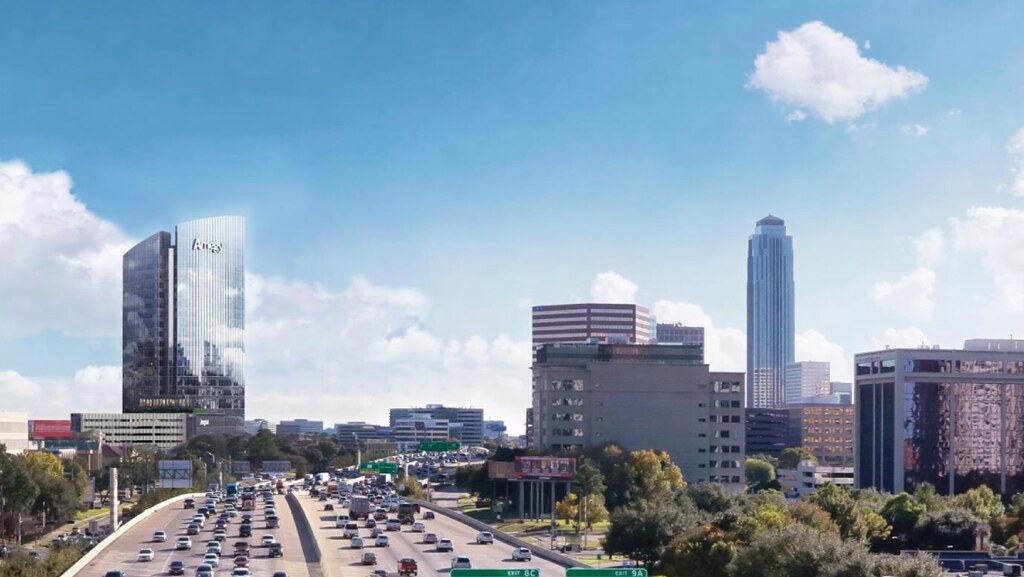
Does anyone know if/where Micro Center would be relocating if this is true?
From Swamplot:
http://swamplot.com/did-micro-center-just-sell-its-houston-location-to-amegy-bank/2014-02-25/
The self-proclaimed “industry insider” behind a new office-space rumor website tells Swamplot that it’s “well-known . . . amongst the tenant/landlord representative crowd” that Amegy Bank has purchased the 4.13-acre site at 1717 West Loop South just north of San Felipe that’s currently home to Houston’s only Micro Center store. The owner and would-be seller of the property, according to county tax records, is the Ohio-based parent company of the 47,800-sq.-ft. computer and electronics store, which has been operating in that location since 1994. There is only one other Micro Center location in Texas.
***
“The property, which is just down the street from [Amegy Bank's] current office at Five Post Oak Park,” reports the rumor site, “is the supposed site for Amegy to build their own 10-12 story office tower. Rumblings suggest that this move is the result of a lease renewal disagreement between Amegy and their current landlord Shorenstein.”
If the rumor is true, would the computer retailer be looking for another Houston location, or just close up shop here? Swamplot has contacted both Micro Center and Amegy Bank for comment. We’ll add an update if we hear anything back.
http://swamplot.com/wp-content/uploads/2014/02/micro-center.jpg
Webcam:
http://www.workzonecam.com/projects/amegybank/amegybank/workzonecam
Renderings:
http://www.justintowart.com/wp-content/uploads/Towart-Work13-Arch-Illustration-6.jpghttp://www.justintowart.com/wp-content/uploads/Towart-Work13-Arch-Illustration-7.jpg

http://swamplot.com/wp-content/uploads/2015/01/amegy-tower-rendering.jpg
-
1
-
-
Wrong thread. Thats Energy Tower IV. But great pics and thanks for the update.
Thanks for fixing it.
-
Wrong thread. Thats Energy Tower IV. But great pics and thanks for the update.
-
In the 2015 ford F-150 video, at 2:15 the navigation has downtown Houston skyline
https://www.youtube.com/watch?v=O65zgOlM4h4&feature=youtube_gdata_player
Screenshot... Which side is this from?
-
I had some time to kill this afternoon so I took I-10 WB to 99 NB and turned back around at Clay Rd. I was surprised to see no U-turn lanes at this intersection. All of the crossings on 99 between I-10 and 1093 have u-turn lanes. Is segment E not supposed to have any or will they come as the surrounding areas develop?
I'm not a long time Houstonian so I dont know the history of existing highways when they were originally developed in new areas. Does anyone know if U-turns historically were added after the area develops?
Also I noticed that on the 99 SB side the I-10 WB signs on the Franz Rd exit have been cleared. I'm not sure when it happened but the 99 SB to I-10 WB direct connector is now open. The mainlanes of 99 SB has a single I-10 east/west BGS with control cities of Houston and San Antonio consigned. Each is on a separate sign near the top of the exit ramp as the lanes split to go their respective ways.
-
Thats interesting. I see the updated imagery now as well on my PC. It must have updated shortly after my post.
-
It's odd that neither Google Maps website or Google Earth have the updated imagery that the Android app version has been showing for almost two weeks now.
-
Imagery is now live on the Google maps mobile app. It is not updated on the website yet. ExxonMobil's campus looks great in the updates. You can see the surrounding areas clearing ground. You can also see ground clearance for Grand Pkwy Segment F2.
-
I was looking at Google Maps at the area around the Palladium Theater and along Grand Parkway and noticed that when I am zoomed in sufficiently on "map" mode, the thumbnail for "earth" mode (which is satellite imagery) on the bottom left corner of my screen shows a more updated satellite imagery than whats shown when I actually click the "earth" button.
Both Google Earth and Google Maps with Satellite Imagery show imagery dated October 2012 for most of this area. Looking at the imagery in the thumbnail, it looks to be from October 2013 (or so I assume based on various developments not being quite December 2013 developed).
Here are some items that I see in the thumbnail, which are not currently shown in Google Earth or Google Maps Satellite view:
-- The new Long Meadow Farms development behind the Palladium and south of Beechnut.
-- Grand Mission Estates shows houses in the sections south of Mason/Bellaire (2012 imagery shows just roads and dirt in place of where houses now stand).
-- Grand Parkway overpasses are shown nearly complete at Belfort, Mason, Harlem, 1464/90, New Territory
-- Grand Parkway overpass at Riverpark now has concrete surface leading up to and away from the overpass that was built last year. 2012 imagery has the asphault(?) base without the concrete overlay.
-- New Belfort extension from Waterview Estates to Harlem
-- Extended S Mason Rd between (just south of) Grand Parkway, through Long Meadow Farms, up to FM 359 is now shown as either completed or with ground cleared (previously it was just a 2 lane road or just grass).
-- Neighborhood streets in new sections in various parts of the maps.
There is a jagged north-south seam (dark vs light) in the thumbnail shot for what seems to be a difference in imagery between Oct 2013/2012 at around Peek Rd, and I followed it north as far as the Houston Premium Outlets in Cypress and south to southwest freeway. It continues well past in both directions but I didn't care to continue further. I could not tell how far east the new imagery lasted, but I briefly looked at some areas I know of recent development on West Sam Houston Tollway, and I didn't see anything updated.
-- due to this "seam", only a portion of Grand Pkwy Segment E is shown, which is just north of Clay Rd, and through the parts that coincide with Stockdick School road up to approximately FM 529. As the road veers slightly west, it is no longer on the new side of the seam, and so the 99/290 interchange is not visible (according to Google Earth, this imagery is dated April 2012 so there is very very little development shown here).
--Additionally it looks like some of the on/off ramps at Clay Rd and FM 529 are starting to be drawn in on the maps view. So maybe the editors have activated the new imagery so it can be traced to show the Segment E that just opened??
I have attached the following, with various 2013 thumbnails superimposed over the 2012 screenshots. The thumbnails are very small and so you have to look very closely for the differences. Also, the zoom levels vary between all of the screenshots and thumbnails, so nothing is to scale, nor is it intended to be. I just threw this together to quickly share what I have seen.
1. A Google Earth screenshot of the 77407 zip code area with the October 2012 dates circled. Google Maps Satellite imagery is the same as this.
2. Google Maps Satellite screenshot of the Grand Pkwy / US 90 alternate area.
3. Grand Parkway Segment E between Clay Rd and FM 529. I'd like to point out that the thumbnail near Clay Rd only shows the north part of the overpass as completed, because this overpass is right on the seam between 2012/2013 imagery and it blends together very nicely, making it seem as if this overpass is incomplete. Look at this one carefully, its kind of cool.
4. A zoomed out thumbnail to show the jagged boundary between 2012/2013 imagery.
I assume that this is just a first pass of loading the new imagery, and Google is working on blending this imagery with the old imagery to make it look as seamless as the rest of the maps. Or maybe they are still loading imagery to the west, as there has been alot of development with the rest of Grand Pkwy, as well as the west side of Katy up to Fulshear.
I also assume that the "updated" imagery will be loaded soon when Google finishes blending the images together, and will also be used to trace over to show new roads.
I don't know how long any of this will be continue to be shown, but I have created the attachements to show what it looks like right now. All of this can either go away back to the
*** Also note that I am using the "new" Google Maps website that was released in recent months. The "old" version didn't show a thumbnail of the Earth/Satellite view, as far as I am aware. So if you do not see what I am looking at, you probably are using the old version, which is the default***
-
1
-
-
I haven't been to Houston since August, but how far does Section E go? Obviously, it connects Katy to Cypress and adds main lanes to 290 (up from Kingsland Blvd., where afterward you would be forced to get on the frontage road or take the ramp to Interstate 10 East). If you were drive north on Grand Parkway, would you be forced to exit onto 290, or would you be able to go to Cumberland as shown in this map?
Here is a picture of the north end of Segment E, possibly taken about a month ago.
Source:
http://coveringkaty.com/2013/12/21/grand-parkway-extension-open-real-estate-boom-expected/


I-45 Rebuild (North Houston Highway Improvement Project)
in Traffic and Transportation
Posted
Why isn't there an option to trench/cap the Pierce, and leave I-45 in its current path of the west side of downtown? Considering that nearly half of I-45 will still remain in place on that side for the the downtown connector and the ROW is already there. The cap would still allow downtown/midtown to be integrated, as opposed to a much wider cap on the east side.